OPERA: Addressing Societal Needs with Satellite Data
Introduction
The Observational Products for End-Users from Remote Sensing Analysis (OPERA) project represents a strategic initiative designed to address critical satellite data needs identified by federal agencies. Established in 2021 by the NASA/Jet Propulsion Laboratory (JPL), OPERA responds to priorities identified by the Satellite Needs Working Group (SNWG), an interagency body convened by the White House Office of Management and Budget (OMB) and Office of Science and Technology Policy (OSTP). SNWG surveys federal agencies every two years to determine their top satellite data needs. This article summarizes OPERA, including its mandate, and then presents a case study demonstrating how the United States Department of Agriculture (USDA) Agricultural Research Service (ARS) is using OPERA to monitor agricultural health in the Midwestern United States.
OPERA Mandate and Approach
The core mandate for the OPERA project lies in its commitment to delivering data products in formats that are immediately usable and analysis-ready. Rather than providing raw satellite data that requires extensive processing expertise, OPERA transforms complex satellite observations into standardized, accessible products that federal agencies can quickly integrate into their existing workflows to support national security, environmental monitoring, disaster response, and infrastructure management. This approach eliminates the technical barriers that often prevent agencies from effectively using satellite data, allowing them to focus on their mission-critical applications rather than data processing challenges.
To achieve this goal at the scale required by federal agencies, OPERA has developed a sophisticated cloud-based production system capable of generating data products efficiently and consistently to meet the dynamic needs of federal users. As of 2025, OPERA has successfully released dynamic surface water extent, surface disturbance, and surface displacement data through various NASA Distributed Active Archive Centers (DAACs). The vertical land motion product will be OPERA’s next offering beginning in 2028 – see Figure 1.
Figure 1. As of 2025, OPERA has successfully released dynamic surface water extent, surface disturbance, and surface displacement data products that are available through various NASA Distributed Active Archive Centers. The vertical land motion product will be OPERA’s next offering beginning in 2028.
Figure credit: Clockwise starting from bottom left. Firth River Yukon, Water Data. Credit: USGS/John Jones, Lava boiling out of the Kilauea Volcano, Volcano Data. Credit: ASI/NASA/JPL-Caltech, Subsidence and uplift over New York City, Vertical Land Motion Data. Credit: NASA/JPL-Caltech, Fire fighting helicopter carry water bucket to extinguish the forest fire, Fire Data. Credit: Hansen/UMD/Google/USGS/NASA
OPERA Mission
OPERA delivers high-quality, ready-to-use satellite-derived information to enable federal agencies to better monitor environmental changes, respond to natural disasters, assess infrastructure risks, and make data-driven decisions. To illustrate this goal, OPERA’s 5th Annual Stakeholder Engagement Workshop detailed real-world applications of this approach on Sept. 11, 2025.
Case Study: Harnessing OPERA Data to Map Crop Health in Midwest United States
When water lingers on farmland, the consequences often ripple outward, resulting in crop losses, changes in soil health, and shifting carbon storage. In the rolling landscape of central Iowa’s South Fork watershed, these challenges are a daily reality for farmers, researchers, and crop insurance companies. To address these concerns, scientists at the U.S. Department of Agriculture–Agriculture Research Service’s (USDA–ARS) National Laboratory for Agriculture and the Environment (NLAE) are partnering with NASA’s OPERA project.
Using OPERA’s Dynamic Surface Water Extent (DSWx) and Surface Disturbance (DIST) product suites, USDA–NLAE researchers began the process of identifying depressions where water consistently ponds across fields – see Figure 2.
Figure 2. The map of maximum inundation combines individual Observational Products for End-Users from Remote Sensing Analysis (OPERA) Dynamic Surface Water Extent (DSWx) granules acquired over a month.
Figure credit: NASA/JPL-Caltech, Dr. Renato Prata de Moraes Frasson
These sites are often more than nuisance puddles; they signal areas of reduced yield, risk for crop mortality, and hotspots for carbon and nutrient accumulation. By combining OPERA’s cloud-free, high-resolution mosaics with field-based measurements from USDA and university partners, the joint OPERA-NLAE team is producing actionable maps that pinpoint waterlogged zones – see Figure 3. Farmers can use these maps to improve soil health and guide land-management decisions.
Figure 3. The map depicts a field south of Iowa Falls in Hardin County, IA. The pixels are color-coded to indicate the number of times a region is inundated with water from May through October 2024. Larger numbers are associated with deeper depressions and with perennial lakes and rivers, including the Iowa River flowing west to east in the northern part of the image.
Figure credit: NASA/JPL-Caltech, Dr. Renato Prata de Moraes Frasson
The OPERA products also support broader watershed management. Analyses of river migration, oxbow lake formation, and storm damage from powerful Midwestern derecho events show how OPERA data extend beyond field plots to larger areas. By detecting both persistent inundation and shifts in vegetation health, DSWx and DIST together provide synergistic information identifying areas where improved tile drainage may result in better crop health and increased yields. This approach can also be used to mitigate topsoil erosion and nutrient transport to control the development of harmful algal blooms and the occurrence of anoxic zones with implications far beyond the Mississippi Delta.
Conclusion
The use of OPERA data by USDA–ARS to map and monitor crop health in the Midwest United States highlights how this vital data product bridges the gap between Earth science and agricultural resilience. The outcome of this collaboration underscores OPERA’s mission – translating cutting-edge satellite observations into usable tools that support farmers, improve soil and water conservation, and strengthen the resilience of U.S. agriculture. This collaboration signifies the mandate of OPERA as an SNWG solution provider to fulfill the observation needs of federal users. All OPERA’s data products are freely available to the public from various NASA DAACs and are discoverable from the NASA Earthdata Search platform. The team welcomes direct engagement with individual federal, state, academic, and commercial stakeholders and can be reached via opera.sep@jpl.nasa.gov.
Steven K. Chan Jet Propulsion Laboratory, California Institute of Technology steven.k.chan@jpl.nasa.gov
Renato Prata de Moraes Frasson Jet Propulsion Laboratory, California Institute of Technology renato.prata.de.moraes.frasson@jpl.nasa.gov
Keeping Up with PACE: Summary of the 2025 PAC3 Meeting
Introduction
Launched in Feb. 2024, NASA’s Plankton, Aerosol, Cloud, ocean Ecosystem (PACE) mission is a cornerstone of Earth system science designed to deepen our understanding of how these environmental and biological components come together to influence our climate, carbon cycle, and ecosystems. PACE has funded three supporting components: the PACE Postlaunch Airborne eXperiment (PACE–PAX), the third PACE Science and Applications Team (SAT3), and the PACE Validation Science Team (PVST). Each group serves distinct but interdependent roles in advancing the scientific objectives of the mission through product development and rigorous assessment of data quality.
Recognizing the interconnected focus areas among these groups, the organizers consolidated this year’s separate gatherings into one comprehensive event – the “PAC3” meeting. The combined meeting took place from Feb. 18–21, 2025 at NASA’s Goddard Institute for Space Studies (GISS) in New York City, just 10 days after the first anniversary of the PACE launch – see Photo 1 and Photo 2.
Photo 1. Plankton, Aerosol, Cloud, ocean Ecosystem (PACE) scientists celebrated the one-year anniversary of the satellite’s orbit (February 8, 2025) during the PAC3 meeting. A “birthday” celebration took place during the meeting, complete with cake. Shown here are [left to right]: Ivona Cetinić [NASA’s Goddard Space Flight Center (GSFC)/Morgan State University, Ocean Ecology Laboratory (OEL)—PACE Validation Science Team lead, PACE-PAX Deputy Mission Scientist], Erin Urquhart Jephson [NASA Headquarters (HQ)—Program Manager of the NASA Earth Action Water Resources Program, PACE Program Applications Lead], Cecile Rousseaux [GSFC, OEL—PACE Science and Applications Team Lead], Kirk Knobelspiesse [GSFC, OEL—PACE Polarimeter Lead, PACE-PAX Mission Scientist], Jeremy Werdell [GSFC, OEL—PACE Project Scientist], Laura Lorenzoni [NASA HQ—Ocean Biology and Biogeochemistry Program Scientist, PACE Program Scientist], Brian Cairns [NASA Goddard Institute for Space Studies (GISS)—PACE Deputy Project Scientist, PACE-PAX Deputy Mission Scientist], and Bryan Franz [GSFC, OEL—PACE Science Data Segment Lead].
Photo credit: Judy Alfter [NASA Ames Research Center (ARC)/Bay Area Environmental Research Institute (BAER)]
Photo 2. With over 100 in-person and virtual attendees, the PAC3 meeting brought together representatives from each of the three overlapping activities for discussions on the status and plans for Plankton, Aerosol, Cloud, ocean Ecosystem (PACE) and related activities. The recently renovated meeting space at the NASA Goddard Institute for Space Studies (GISS) in New York City provided an ideal venue for interdisciplinary discussions and knowledge-sharing.
PACE’s long-term objectives focus on understanding ocean and terrestrial ecosystem productivity, detecting harmful algal blooms, exploring relationships between aerosols and clouds, and integrating these insights into Earth system science to enhance both research and decision-making capacities. These goals are accomplished by the advanced suite of three complementary instruments.
The Ocean Color Instrument (OCI) is a hyperspectral radiometer that measures ocean ecosystems’ biological, biogeochemical, and physical dynamics by capturing light over hundreds of narrow wavelengths from the deep ultraviolet to the infrared. Additionally, the broad spectral range and spectral resolution of the measurements allow the research community to characterize aerosols, clouds, land surfaces, and trace gases.
The Hyper-Angular Rainbow Polarimeter #2 (HARP2) is a multiangle polarimeter with a wide swath, four visible–near infrared (VIS–NIR) spectral channels, and between 10 and 60 viewing angles (i.e., the hyperangular capability) in each spectral channel. HARP2 is designed for retrieval of cloud and aerosol properties.
The Spectropolarimeter for Planetary Exploration (SPEXone) is also a multiangle polarimeter with different and complementary properties to HARP2. SPEXone has a narrow swath and five viewing angles with a spectral sensitivity of 100 bands from the ultraviolet to the near infrared. It is optimized for the retrieval of aerosol properties.
More details about the PACE mission can be found at its website.
PACE Mission Updates
The PAC3 meeting included a review of the PACE mission’s status and recent developments. This overview included meeting status updates on OCI, SPEXone, and HARP2 from their respective instrument scientists: Gerhard Meister [NASA’s Goddard Space Flight Center (GSFC)], Otto Hasekamp [Space Research Organization, Netherlands (SRON)], and Vanderlei Martins [University of Maryland, Baltimore County (UMBC)]. This section of the meeting covered updates on the early mission data availability and accessibility, including a review of the PACE data website. These details are summarized on the PACE data availability website and the ‘help hub’.
OCI
Meister reported that OCI has exceeded radiometric performance requirements, delivering highly accurate hyperspectral data. He noted that, with the release of Version 3 (V3) data reprocessing, OCI calibration now uses only on-orbit solar diffuser measurements to improve temporal stability. Key improvements of V3 include enhanced corrections for atmospheric absorbing gas effects and updated bidirectional reflectance distribution function (BRDF) parameters. Meister said that analysis of temporal trends has revealed solar diffuser degradation in the ultraviolet range, with ongoing corrections being made. For example, he cited how the team is using the solar diffuser that is only exposed once a month to correct the observations of the solar diffuser that is exposed daily. He also discussed other anomalies, including striping around 10° scan angle, reduced accuracy in the 590–610 nm region and implementation of crosstalk correction to compensate for reduced accuracy of wavelength measurements in the ultraviolet (i.e., for wavelengths shorter than 340 nm).
SPEXone
Hasekamp reported that SPEXone is delivering quality radiometric and polarimetric data. The team has developed the Remote Sensing of Trace Gases and Aerosol Products (RemoTAP) algorithm, an advanced aerosol retrieval algorithm that determines the total atmospheric column of aerosols, aerosol size distribution information, energy absorbed by aerosols, and vertical extent of the aerosol layer. Hasekamp showed that observations demonstrate minimal bias in size distribution retrievals across low aerosol optical depth (AOD) environments and these observations have good agreement with observations from ground-based Sun photometers that are part of the Aerosol Robotic Network (AERONET). He added that future updates will address radiometric calibration discrepancies with OCI.
HARP2
Martins reported that HARP2 continues to perform well and is delivering polarization-sensitive observations of aerosols and clouds. He noted that plans include making continued geolocation and calibration refinements, as well as cross-calibration with OCI and SPEXone to harmonize all the PACE radiometric data products.
PACE Data Access and Website Resources
Several presentations outlined the tools and platforms available to make data from the PACE mission accessible to the broader scientific community.
Carina Poulin [GSFC/Science Systems and Applications, Inc (SSAI)] provided an overview of the PACE Data Website, which serves as a central hub for accessing datasets, reprocessing information, and product tutorials. The V3 landing page provides details on calibration updates, validation results, and pathways for integrating PACE data into user workflows.
EarthCARE Mission Updates
Many of PACE’s science objectives dovetail with that of the Earth Clouds, Aerosols, and Radiation Explorer (EarthCARE), a joint venture by the European Space Agency (ESA) and Japan Aerospace Exploration Agency (JAXA). Hence, the PAC3 meeting included participation from the EarthCARE teams. The EarthCARE observatory has four advanced instruments: a high spectral resolution ATmospheric LIDar (ATLID), a doppler capable Cloud Profiling Radar (CPR), a Multi-Spectral Imager (MSI), and a Broad-Band Radiometer (BBR). The measurements from EarthCARE complement those of PACE and enable cross validation, enriching scientific knowledge of complex Earth system processes. The synergistic nature of these missions also means that validation activities for one are well suited to both. For example, the Plankton, Aerosol, Cloud, ocean Ecosystem Postlaunch Airborne eXperiment (PACE-PAX) field campaign (discussed later in this article) incorporated validation activities for EarthCARE, and EarthCARE funded campaigns have made observations during PACE overpasses.
Rob Koopman [ESA] outlined progress on EarthCARE, including preparation for validation activities as part of ESA and JAXA’s joint efforts. He reported that the mission’s ATLID lidar data products are in excellent alignment with airborne High Spectral Resolution Lidar (HSRL) datasets (flown during PACE-PAX). Koopman showed preliminary results from underflights with NASA aircraft that demonstrate high accuracy for cloud and aerosol retrieval, albeit with some calibration challenges that will require further refinement. He also said that several EarthCARE–PACE mutual validation campaigns are planned to ensure inter-mission consistency across critical science products.
PACE–PAX Sessions
The first component of the PAC3 meeting focused on PACE–PAX, a field campaign conducted in California and adjacent coastal regions during Sept. 2024 – see Figure 1. Kirk Knobelspiesse [GSFC, OEL—PACE Polarimeter Lead, PACE-PAX Mission Scientist], Ivona Cetinić [NASA’s Goddard Space Flight Center (GSFC)/Morgan State University, Ocean Ecology Laboratory (OEL)—PACE Validation Science Team lead, PACE-PAX Deputy Mission Scientist], and Brian Cairns [NASA Goddard Institute for Space Studies (GISS)—PACE Deputy Project Scientist, PACE-PAX Deputy Mission Scientist] led the campaign, which, in addition to personnel from most NASA Centers, had participation from academia (e.g., University of Maryland, Baltimore County), other government agencies (e.g., Naval Postgraduate School and National Oceanic and Atmospheric Administration), and international space agencies (e.g., Space Research Organization, Netherlands).
Figure 1. Montage of activities during the Plankton, Aerosol, Cloud, ocean Ecosystem Postlaunch Airborne eXperiment (PACE–PAX) field campaign, which successfully concluded on Sept. 30, 2024. The campaign made atmospheric, ocean, and land surface measurements to validate observations from the recently launched NASA PACE and European Space Agency (ESA) and Japan Aerospace Exploration Agency (JAXA) Earth Clouds, Aerosols, and Radiation Explorer (EarthCARE) missions. Clockwise from top left: Mike Ondrusek [NOAA R/V Shearwater Mission Scientist] waves to the Naval Postgraduate School (NPS) Twin Otter as it performs a low altitude sample. Photo of the Bridge fire from Kirt Stallings [NASA ARC Earth Resources-2 (ER-2) Pilot]. Carl Goodwin [NASA/Jet Propulsion Laboratory] performs calibration at Ivanpah Playa, CA, the primary reference site for space-based remote sensing observations located in the Mojave Desert. Scott Freeman and Harrison Smith [both GSFC] deploy instrumentation from the R/V Shearwater in the Santa Barbara Channel. Instrument integration on the NASA ER-2 in preparation for PACE-PAX. San Francisco observed by the NPS Twin Otter as it samples at low altitude over the San Francisco Bay. The R/V Shearwater seen from the NPS Twin Otter.
Figure credit(s): Clockwise from top left: NASA; Kirt Stallings; Regina Eckert [NASA/Jet Propulsion Laboratory]; Luke Dutton [National Oceanic and Atmospheric Administration]; Martijn Smit [Space Research Organization, Netherlands]; Luke Ziemba [NASA’s Langley Research Center (LaRC)]; Luke Ziemba.
Campaign Overview
The PACE–PAX mission supported the PACE Science Data Product Validation Plan. This included validation of new PACE and EarthCARE products, data collection during instrument overpasses, verification of radiometric and polarimetric measurements, and targeted investigation of region-specific phenomena (e.g., multilayer aerosols and phytoplankton blooms).
Operational Highlights
PACE–PAX used a diverse array of platforms to collect atmospheric and oceanic data, including aircraft [e.g., NASA Earth Resources-2 (ER-2) and the Naval Postgraduate School’s Center for Interdisciplinary Remotely Piloted Aircraft Studies (CIRPAS) Twin Otter], research vessels (NOAA’s R/V Shearwater and the 30-foot sailboat R/V Blissfully), and ground-based instruments such as Sun photometers and lidars. Key achievements include 13 ER-2 and 17 Twin Otter science flights, 15 RV Shearwater and 9 R/V Blissfully day cruises. These flights and ocean surveys supported 16 days of observations during a PACE overpass, six days of observations during an EarthCARE overpass, ground vicarious calibration at Ivanpah Playa, CA, numerous overflights of AERONET ground sites. Beyond validation, several unique events were observed that may be of interest for scientific purposes. Intense wildfires (e.g., the Bridge, Airport, and Line fires in 2024) were observed in Southern California in mid-September, while a red tide outbreak was observed later in the month along the Northern California coast – see Figure 2. Additionally, elements of the PVST coordinated their own validation efforts with the PACE–PAX campaign.
Figure 2. Red tide blooms in Northern California as seen from three remote sensing tools on the Plankton, Aerosol, Cloud, ocean Ecosystem Postlaunch Airborne eXperiment (PACE–PAX). [Left] An image taken from the NPS Twin Otter on Sept. 24, 2024. [Right] The PACE Ocean Color Instrument (OCI) image collected on Sept. 27, 2024 with modified red-tide index applied to OCI data. [Center Inset] An Imaging FlowCytobot (IFCB) image taken on Sept. 27, 2024 at the Santa Cruz, CA pier.
Figure Credits: [Left] Eddie Winstead [NASA’s Langley Research Center (LaRC)]; [right] NASA; [inset] Clarissa Anderson [University of California, San Diego]
Preliminary Findings
Highlights of the PACE-PAX sessions demonstrated:
validation of EarthCARE and PACE aerosol and cloud products using the HSRL2 on NASA ER-2,
validation of PACE cloud products using polarimeters operating on the NASA ER-2 and in situ sensors on the CIRPAS Twin Otter,
numerous successful matchups of hyperspectral data from OCI on PACE with field measurements of chlorophyll-a captured during ship campaigns, and
observations of diverse phenomena (e.g., marine stratocumulus clouds and transported wildfire aerosols over clouds), which supported the testing of new retrieval algorithms.
The early results show the critical role that validation activities, such as PACE–PAX, play in creating a bridge between orbital science and ground truth.
PACE Science and Application Team (SAT3)Session
SAT3, with a focus on both science and applications, offered a compelling second component of the PAC3 meeting. The Earth Observer has previously reported on PACE applications, most recently in the 2023 article, Preparing for Launch and Assessing User Readiness: The 2023 PACE Applications Workshop [Nov–Dec 2023, 35:6, 25–32]. The SAT3 team convened during PAC3 to explore how PACE data could enhance research in diverse scientific fields and support applied uses for societal benefit. Dedicated sessions provided updates on ongoing NASA-funded projects to retrieve new geophysical variables, improve data assimilation, and refine product development pipelines.
SAT3 teams presented early results including studies that use PACE’s OCI to make pigment-specific absorption measurements, study diatom biomass retrieval, and gather chlorophyll concentration estimation. These studies emphasized new tools for tracking individual phytoplankton groups, such as diatoms and cyanobacteria that are vital for ecosystem research and understanding phytoplankton dynamics. Participants also showcased efforts to develop predictive models for the detection of harmful algal blooms (HABs) and improvement of early warning systems to mitigate public health impacts and economic consequences in both coastal regions and the Great Lakes. Several presentations highlighted new aerosol absorption and scattering measurements that are using polarimetry (i.e., SPEXone and HARP2) and how these findings are being incorporated into models of aerosol–cloud radiative forcing. Presenters also described how machine learning tools can integrate PACE measurements into Earth system models, through innovations in data assimilation, with promising results for global climate monitoring.
The SAT3 discussions highlighted PACE’s potential to impact disciplines ranging from oceanography to climate science.
PACE Validation Science Team Sessions
Sessions dedicated to the PACE PVST emphasized the ongoing role of PVST initiatives in confirming the reliability, accuracy, and long-term stability of PACE data products. Topics of focus for the PVST group included algorithm development and validation, cross-mission synergies, field-based campaign integration, and cloud products.
Some of the presenters shared updates on validation pipelines for radiometric and polarimetric products, with an emphasis on comparing against well-characterized datasets from AERONET Sun photometers, HSRL, and the Pan-and-Tilt Hyperspectral Radiometer (PANTHR) developed by Vlaams Instituut voor de Zee (VLIZ), or the Flanders Marine Institute, Belgium – see Photo 3. This radiometer was installed on a 30-m (~98-ft) tower in the Chesapeake Bay in May 2024 and is part of WATERHYPERNET network, which seeks to provide time series of hyperspectral water reflectance data from oceanic, coastal, and inland waters for the validation of satellite data at all wavelengths in the range 400–900 nm.
Photo 3. Inia Soto Ramos [Goddard Space Flight Center/Morgan State University] leads a Plankton, Aerosol, Cloud, ocean Ecosystem (PACE) Validation Science Team (PVST) breakout group discussion.
Photo credit: Judy Alfter [NASA Ames Research Center (ARC)/ Bay Area Environmental Research Institute (BAER)]
Reports from PVST members highlighted how data from PACE–PAX campaigns and satellite overpasses are contributing to the validation of error budgets developed prelaunch and refined uncertainty characterization. Other presentations highlighted the development of validation strategies for PACE-derived cloud properties, including cloud optical thickness, top height, and droplet size distributions with significant contributions from EarthCARE observations. Ocean observation validation was represented as well, with presentations from many groups that are focusing on retrieval of not only oceanic optical properties but biological components. This data offers crucial validation for the advanced phytoplankton composition and general ocean productivity products from PACE.
The PVST’s work continues to provide the foundation for confidence in PACE data products. Their accuracy ensures broad usability of those products across global science applications.
Conclusion
The PAC3 meeting, held at NASA’s GISS, highlighted the collective efforts of the PACE mission’s diverse teams to address a broad range of Earth system science challenges. By combining the meetings for PACE–PAX, SAT3, and PVST, participants were able to strengthen collaborations, align ongoing efforts, and lay the groundwork for future research and validation activities.
Roundtable discussions and team updates also revealed the critical role of PACE in addressing long-standing Earth system science questions, such as understanding the influence of aerosols on cloud formation and characterizing the impacts of oceanic changes on global biogeochemical cycles at a global scale. The meeting concluded with participants compiling action items for further exploration. Topics identified for future efforts included strategies for ensuring long-term data calibration, improving data delivery pipelines, and refining algorithm development processes.
This meeting was one of the last significant events hosted at GISS before the facility’s closure at the end of May 2025. The findings and outcomes from PAC3 continue to inform and inspire PACE mission science, further enhancing its importance in advancing our understanding of the Earth system.
Sentinels in the Sky: 50 Years of GOES Satellite Observations
Introduction
In an era where satellite observations of Earth are commonplace, it’s easy to forget that only a few decades ago, the amount of information available about the state of Earth’s environment was limited; observations were infrequent and data were sparsely located.
As far back as the late 1950s, there were primitive numerical weather prediction (NWP) models that could produce anaccurate (or what a forecaster would call “skillful”) forecast given a set of initial conditions. However, the data available to provide those initial conditions at that time were limited. For example, the weather balloon network circa 1960 only covered about 10% of the troposphere and did not extend into the Southern Hemisphere, the tropics, or over the ocean.
Weather forecasters of the pre-satellite era typically relied upon manual analysis of plotted weather maps, cloud observations, and barometric pressure readings when making forecasts. They combined this limited dataset with their own experience issuing forecasts in a particular area to predict upcoming weather and storm events. While those pioneering forecasters made the most of the limited tools available to them, poor data – or simply the lack of data – inevitably led to poor forecasts, which usually weren’t accurate beyond two days. This time duration was even less than that in the Southern Hemisphere. As a result, the forecasts issued typically lacked the specificity and lead time required to adequately prepare a community before a snowstorm or hurricane.
Although the first satellite observations (e.g., from the Television Infrared Observation Satellite (TIROS) program or early Nimbus missions) whet forecasters’ appetites for what might be possible in terms of improving weather forecasting, polar orbiting satellites could only observe a given location twice a day. Those snapshots from above were insufficient for tracking rapidly evolving weather phenomena (e.g., thunderstorms, tornadoes, and intensification of hurricanes). Beyond cloud information, forecasters required data on temperature, moisture, and wind profiles in the atmosphere in addition to output from NWP models.
It was the advent of geostationary observations (also called geosynchronous) that truly led to revolutionary advances in weather forecasting. This approach enabled continuous monitoring of the atmosphere over a particular region on Earth. Hence, the development and evolution of NOAA’s Geostationary Operational Environmental Satellites (GOES) has been a major achievement for weather forecasting.
For 50 years, GOES have kept a constant vigil over the Western Hemisphere and monitored the Sun and the near-Earth environment – see Visualization 1. Since 1975, the National Oceanic and Atmospheric Administration (NOAA) and NASA have partnered to advance NOAA satellite observations from geostationary orbit. GOES satellites serve as sentinels in the sky, keeping constant watch for severe weather and environmental hazards on Earth as well as dangerous space weather. This narrative will focus on the development and evolutions of the Earth observing instruments on GOES with a mention of several of the space weather instruments.
Visualization 1. A YouTube video, created for the 50th anniversary of GOES, examines the partnership between the National Oceanic and Atmospheric Administration (NOAA) and NASA to advance NOAA satellite observations from geostationary orbit to monitor for weather and environmental hazards on Earth as well as dangerous space weather. Visualization credit: NOAA/NASA
The article provides the history leading up to the development of GOES and traces the development of GOES from the earliest launch in 1975 to the last launch in late 2024, which completed the GOES–R series – see Figure 1. The article ends with a look at the plans for Geostationary Extended Observations (GeoXO), which seeks to extend the GOES legacy to the middle of the 21st century, followed by some concluding thoughts.
Figure 1. Timeline of GOES launches including key technological developments associated with each “generation” of satellites.
Figure credit: NOAA/NASA
GOES Heritage Missions: ATS and SMS
The heritage of GOES can be traced to the Applications Technology Satellite (ATS) series, which consisted of a set of six NASA spacecraft launched from December 7, 1966 to May 30, 1974. These missions were created to explore and flight-test new technologies and techniques for communications, meteorological, and navigation satellites. ATS was a multipurpose engineering satellite series, testing technology in communications and meteorological applications from geosynchronous orbit.
ATS satellites aimed to test the theory that gravity would anchor a satellite in a synchronous orbit, 22,300 statute miles (37,015 km) above the Earth. This orbit allowed the satellites to move at the same rate as the Earth, thus seeming to remain stationary. Although the ATS satellites were intended mainly as testbeds, they also collected and transmitted meteorological data and functioned at times as communications satellites. For example, ATS-6, the last in the series, was the first to use an education and experimental direct broadcast system, which is now commonplace on Earth observing satellites (e.g., Terra).
Also included in the ATS payload was a spin-scancamera that Verner Suomi and associates had developed in the early 1960s. The device was so named because it compensated for the motion of the satellite and still obtained clear visible (television-like) photographs. The University of Wisconsin, Madison’s (UWM) Space Science and Engineering Center (SSEC), which Suomi and colleagues at UWM had just recently established, funded the camera’s development and NASA approved its inclusion as part of the ATS payload. The spin-scan camera on ATS-1 produced spectacular full disk images of Earth; a few years later the camera on ATS-3 produced similar images, this time in color.
Although designed primarily to test and demonstrate new technologies, imagery captured by the ATS payload led to some serendipitous science. Analysis of spin-scan camera images, while labor intensive and expensive and not practical for use operationally, led to new discoveries about storm origins that had never before been available. For example, Tetsuya Fujita analyzed ATS camera images of storms in the Midwest United States in 1968 as part of his in-depth studies of tornadoes. This work led to the development of the Fujita Scale for tornado intensity. Also in 1968, “Hurricane Hunter” aircraft data and radar imagery, along with ATS images allowed meteorologists to observe the complete life cycle of Hurricane Gladys. Today, this approach is routine, but at the time it was groundbreaking.
Following the success of the ATS “technology demonstration” series, NASA and NOAA began to develop an operational prototype of the dedicated geosynchronous weather satellite, the Synchronous Meteorological Satellite (SMS). SMS-1 was launched in 1974, with SMS-2 following the next year. Owned and operated by NASA, the SMS satellites were the first operational satellites designed to sense meteorological conditions in geostationary orbit over a fixed location on the Earth’s surface. The ATS spin-scan camera manufacturers – SSEC and Santa Barbara Research – altered their ATS camera design, replacing the television-like photographic apparatus with an imaging radiometer with eight visible and three infrared channels. The revised instrument became known as the Visible and Infrared Spin-Scan Radiometer (VISSR). They also added a telescope that would allow for high-resolution imaging of smaller portions of Earth, allowing researchers to study storm formation in more detail.
First Generation: GOES 1–3
The GOES era began in October 1975 with the launch of GOES-1 (initially called SMS-3). The first three GOES missions were spin-stabilized satellites. The VISSR instrument, initially developed for the SMS missions, became the workhorse instrument for the first generation of GOES missions. VISSR provided high-quality day and night observations of cloud and surface temperatures, cloud heights, and wind fields – see Figure 2.
The early GOES missions also focused on monitoring space weather. The first generation of GOES featured a Space Environment Monitor (SEM) to measure proton, electron, and solar X-ray fluxes as well as magnetic fields around the satellites. This technology became standard on all subsequent GOES satellite missions.
Figure 2. First image from GOES-1 obtained on October 25, 1975.
Figure credit: NOAA
The new satellites quickly began providing critical information about the location and trajectory of hurricanes. The earliest generation of GOES provided crucial data about Tropical Storm Claudette and Hurricane David in 1979 – both of which devastated regions of the United States.
Second Generation: GOES 4–7
The second generation of GOES began in 1980, with the launch of GOES-4. NASA, NOAA, and SSEC collaborated to make further enhancements to the VISSR instrument, adding temperature sounding capabilities. The development of the VISSR Atmospheric Sounder (VAS) was particularly helpful for the study and forecasting of severe storms. While there were sounders on polar orbiting satellites of this era (e.g., TIROS and Nimbus), polar orbiters, which take measurements of the same location twice daily, often missed events that occurred on shorter timescales, such as thunderstorms. By contrast, VAS on GOES could image the same area every half-hour, allowing for more detailed tracking of storms, leading to improved severe storm forecasting and enabling more advanced warning of the storm’s arrival. VAS became the basis for the establishment of an extensive severe storm research program during the 1980s.
The second generation GOES missions were capable of obtaining vertical profiles of temperature and moisture throughout the various layers of the atmosphere. This added dimension gave forecasters a more accurate picture of a storm’s extent and intensity, allowed them to monitor rapidly changing events, and helped to predict fog, frost, and freeze, as well as dust storms, flash floods, and even the likelihood of tornadoes.
The second generation of GOES helped forecasters track and forecast the impacts from the 1982–1983 El Niño event – one of the strongest El Niño–Southern Oscillation (ENSO) events on record that led to significant economic losses. This generation of GOES satellites also gave forecasters vital information about Hurricane Juan in 1985 and Hurricane Hugo in 1989, both destructive storms for areas of the United States – see Figure 3.
Figure 3. GOES-7 infrared image of Hurricane Hugo on September 22, 1989.
Figure credit: NOAA
GOES-7, launched in 1987, added the new capability of detecting distress signals from emergency beacons. These GOES satellites have helped to rescue thousands of people as part of the Search and Rescue Satellite-Aided Tracking (SARSAT) system developed to detect and locate mariners, aviators, and other recreational users in distress. This system uses a satellite network to detect and locate distress signals from emergency beacons on aircraft and vessels and from handheld personal locator beacons (PLBs) quickly. The SARSAT transponder on GOES immediately detects distress signals from emergency beacons and relays them to ground stations. In turn, this signal is routed to a SARSAT mission control center and then sent to a rescue coordination center, which dispatches a search and rescue team to the location of the distress call.
Third Generation: GOES 8–12
In 1994, advances in two technologies enabled another significant leap forward in capabilities for GOES: improved three-axis stabilization of the spacecraft and separating the imager and sounder into two distinct instruments with separate optics (e.g., GOES Imager and GOES Sounder). Simultaneous imaging and sounding gave forecasters the ability to use multiple measurements of weather phenomena, resulting in more accurate forecasts. Another improvement was flexible scanning, where the satellites could temporarily suspend their routine scans of the hemisphere to concentrate on a small area to monitor quickly evolving events. This capability allowed meteorologists to study local weather trouble spots, improving short-term forecasts.
In 2001, forecasters used GOES-8 to track the slow-moving remnants of Tropical Storm Allison, stalled over the Gulf Coast. During the next four days, Allison dropped more than three feet of rain across portions of coastal Texas and Louisiana, causing severe flooding, particularly in the Houston area.
GOES-12, the final satellite in the third generation, launched in 2001. It included a new Solar X-ray Imager (SXI) as part of its payload. SXI was the first X-ray telescope that could take a full-disk image of the Sun, which enabled forecasters to detect solar storms and better monitor and predict space weather that could affect Earth. Some geomagnetic storms can damage satellites, disrupting communications and navigation systems, impacting power grids, and harming astronauts in space.
Fourth Generation: GOES 13–15
By the mid-2000s, the fourth generation of GOES, known as the GOES-N series, enhanced the mission with improvements to the Image Navigation and Registration subsystem, including star-trackers, to better determine the coordinates of intense storms. Improvements in batteries and power systems allowed this generation to provide continuous imaging. GOES-13 also added an Extreme Ultraviolet Sensor, which monitored ultraviolet emissions from the Sun as well as the solar impact on satellite orbit drag and radio communications.
In April 2011, GOES-13 monitored the record-breaking tornado outbreak that hit the Southeastern United States – see Visualization 2. From April 25–28, 362 tornadoes carved a path across a dozen states, leaving an estimated 321 people dead. In 2012, NOAA operated GOES-14, the on-orbit backup satellite, in a special rapid-scan test mode, providing one-minute imagery of Tropical Storm Isaac and Hurricane Sandy, both destructive storms.
Visualization 2. GOES-13 visible imagery showing clusters of severe thunderstorms on April 27, 2011, that spawned several tornadoes.
Visualization credit: NOAA
The GOES-R Series: GOES-16–19
NASA launched the first satellite in the GOES-R Series for NOAA in 2016. The GOES-R Series brought new state-of-the-art instruments into orbit, including the Advanced Baseline Imager (ABI), a high-resolution imager with 16 channels, and the Geostationary Lightning Mapper, the first lightning mapper flown in geostationary orbit. The satellites also gained the ability to concurrently provide a full-disk image every ten minutes, a contiguous United States image every five minutes, and two smaller localized images every 60 seconds (or one domain every 30 seconds). For the first time, meteorologists could see the big picture while simultaneously zooming in on a specific weather event or environmental hazard.
The latest GOES satellite series brought revolutionary improvements, providing minute-by-minute information to forecasters, decision-makers, and first responders to give early warning that severe weather is forming, monitor and track the movement of storms, estimate hurricane intensity, detect turbulence, and even spot fires before they are reported on the ground.
The GOES-R Series satellites also carry a suite of sophisticated solar imaging and space weather monitoring instruments. The final satellite in the series, GOES-19, is also equipped with NOAA’s first compact coronagraph (CCOR-1). This instrument images the solar corona (the outer layer of the Sun’s atmosphere) to detect and characterize coronal mass ejections, which can disrupt Earth’s magnetosphere, leading to geomagnetic storms, auroras, and potential disruptions to technology, including electricity and satellite communications.
In 2017, Hurricane Maria knocked out Puerto Rico’s radar just before landfall. With this critical technology disabled and a major hurricane approaching, forecasters used 30-second data from GOES-16 to track the storm in real-time – see Visualization 3. The satellite’s rapid scanning rate allowed forecasters to analyze cloud patterns and understand the evolution of Maria’s position and movement as well as discern the features within the hurricane’s eye to estimate intensity.
Visualization 3. GOES-16 GeoColor image of Hurricane Maria over Puerto Rico as it made landfall on September 20, 2017.
Visualization credit: NOAA/CIRA
The most recent generation of satellites also significantly improved fire detection and monitoring. During California’s Camp Fire in 2018, GOES-16 played a crucial role in monitoring the fire’s progression and smoke plumes, assisting the efforts to contain the fire – see Visualization 4. The satellite provided an extremely detailed picture of fire conditions, quick detection of hot spots, and the ability to track the fire’s progression and spread in real-time. Forecasters used ABI data from GOES-16 to track the fire’s movement and intensity even before ground crews could fully see it due to thick smoke. Not only did the data help firefighters fight the fire more effectively, but it also helped keep firefighters safe during the disaster.
Visualization 4. Fire hot spots and a large plume of smoke are seen in this GOES-16 fire temperature red-green-blue imagery with GeoColor enhancement of the Camp Fire in northern California on November 8, 2018.
Visualization credit: NOAA/CIRA
What’s Next? GeoXO
NOAA, NASA, and industry partners are now developing the future generation of geostationary satellites. The Geostationary Extended Observations (GeoXO) will provide continuity of observation from geostationary orbit as the GOES-R series nears the end of its operational lifetime. The first GeoXO launch is planned for launch in the early 2030s.
GeoXO will prioritize and advance forecasting and warning of severe weather. Similar to GOES, the information GeoXO gathers will also be used to detect and monitor environmental hazards (e.g., wildfires, smoke, dust, volcanic ash, drought, and flooding).
The more advanced observing capabilities will allow forecasters to provide earlier warning to decision makers, improve the skillfulness of short-term forecasting, and allow for greater lead times for warnings of severe weather and other hazards that threaten the security and well-being of everyone in the Western Hemisphere well into the 2050s.
Conclusion
For 50 years, GOES satellites have provided the only continuous coverage of the Western Hemisphere. Their data have been the backbone of short-term forecasts and warnings of severe weather and environmental hazards. GOES detect and monitor events as they unfold, providing forecasters with real-time information to track hazards as they happen. They are also part of a global ring of satellites that contribute data to numerical weather prediction models. GOES also monitors the Sun and provides critical data for forecasts and warnings of space weather hazards.
Each successive generation of GOES has brought advancements and new capabilities that have improved the skill of short-term weather forecasts and our ability to prepare for and respond to severe weather and natural disasters. The information the satellites supply is essential for public safety, protection of property, and efficient economic activity. Meteorologists, emergency managers, first responders, local officials, aviators, mariners, researchers, and the general public depend on GOES. Everyone in the Western Hemisphere benefits from GOES data each and every day.
Acknowledgment
The primary source for the information provided in the section on “GOES Heritage Missions” was Conway, Eric: Atmospheric Science at NASA: A History (2008), pp. 140–41.
A pilot signals to a crew member before takeoff from NASA’s Armstrong Flight Research Center in Edwards, California, on Aug. 21, 2025. Accompanying him in the high-flying ER-2 aircraft is one of the most advanced imaging spectrometers in the solar system.
NASA/Christopher LC Clark
Called AVIRIS-5, it’s the latest in a long line of sensors pioneered by NASA JPL to survey Earth, the Moon, and other worlds.
Cradled in the nose of a high-altitude research airplane, a new NASA sensor has taken to the skies to help geoscientists map rocks hosting lithium and other critical minerals on Earth’s surface some 60,000 feet below. In collaboration with the U.S. Geological Survey (USGS), the flights are part of the largest airborne campaign of its kind in the country’s history.
But that’s just one of many tasks that are on the horizon for AVIRIS-5, short for Airborne Visible/Infrared Imaging Spectrometer-5, which has a lot in common with sensors used to explore other planets.
NASA’s AVIRIS flies aboard a research plane in this animation, detecting minerals on the ground such as hectorite — a lithium-bearing clay — by the unique patterns of light that they reflect. The different wavelengths, measured in nanometers, look like colorful squiggles in the box on the right. Credit: NASA’s Conceptual Image Lab
About the size of a microwave oven, AVIRIS-5 detects the spectral “fingerprints” of minerals and other compounds in reflected sunlight. Like its cousins flying in space, the sensor takes advantage of the fact that all kinds of molecules, from rare earth elements to flower pigments, have unique chemical structures that absorb and reflect different wavelengths of light.
The technology was pioneered at NASA’s Jet Propulsion Laboratory in Southern California in the late 1970s. Over the decades, imaging spectrometers have visited every major rocky body in the solar system from Mercury to Pluto. They’ve traced Martian crust in full spectral detail, revealed lakes on Titan, and tracked mineral-rich dust across the Sahara and other deserts. One is en route to Europa, an ocean moon of Jupiter, to search for the chemical ingredients needed to support life.
Image cubes illustrate the volume of data returned by JPL imaging spectrometers. The front panel shows roads and fields around Tulare, California, as seen by AVIRIS-5 during a checkout flight earlier this year. The side panels depict the spectral fingerprint captured for every point in the image.
NASA/JPL-Caltech
Another imaging spectrometer, NASA’s Moon Mineralogy Mapper, was the first to discover water on the lunar surface in 2009. “That dataset continues to drive our investigations as we look for in situ resources on the Moon” as part of NASA’s Artemis campaign, said Robert Green, a senior research scientist at NASA JPL who’s contributed to multiple spectroscopy missions across the solar system.
Prisms, black silicon
While imaging spectrometers vary depending on their mission, they have certain hardware in common — including mirrors, detector arrays, and electron-beam gratings — designed to capture light shimmering off a surface and then separate it into its constituent colors, like a prism.
Light-trapping black silicon is one of the darkest materials ever fabricated. The technology is standard for JPL’s ultraprecise imaging spectrometers.
NASA/JPL-Caltech
Many of the best-in-class imaging spectrometers flying today were made possible by components invented at NASA JPL’s Microdevices Laboratory. Instrument-makers there combine breakthroughs in physics, chemistry, and material science with the classical properties of light discovered by physicist Isaac Newton in the 17th century. Newton’s prism experiments revealed that visible light is composed of a rainbow of colors.
Today, NASA JPL engineers work with advanced materials such as black silicon — one of the darkest substances ever manufactured — to push performance. Under a powerful microscope, black silicon looks like a forest of spiky needles. Etched by lasers or chemicals, the nanoscale structures prevent stray light from interfering with the sample by trapping it in their spikes.
Treasure hunting
The optical techniques used at the Microdevices Laboratory have advanced continuously since the first AVIRIS instrument took flight in 1986. Four generations of these sensors have now hit the skies, analyzing erupting volcanoes, diseased crops, ground zero debris in New York City, and wildfires in Alabama, among many other deployments. The latest model, AVIRIS-5, features spatial resolution that’s twice as fine as that of its predecessor and can resolve areas ranging from less than a foot (30 centimeters) to about 30 feet (10 meters).
So far this year, it has logged more than 200 hours of high-altitude flights over Nevada, California, and other Western states as part of a project called GEMx (Geological Earth Mapping Experiment). The flights are conducted using NASA’s ER-2 aircraft, operated out of the agency’s Armstrong Flight Research Center in Edwards, California. The effort is the airborne component of a larger USGS initiative, called Earth Mapping Resources Initiative (Earth MRI), to modernize mapping of the nation’s surface and subsurface.
The NASA and USGS team has, since 2023, gathered data over more than 366,000 square miles (950,000 square kilometers) of the American West, where dry, treeless expanses are well suited to mineral spectroscopy.
An exciting early finding is a lithium-bearing clay called hectorite, identified in the tailings of an abandoned mine in California, among other locations. Lithium is one of about 50 minerals at risk of supply chain disruption that USGS has deemed critical to national security and the economy.
Helping communities capture new value from old and abandoned prospects is one of the long-term aspirations of GEMx, said Dana Chadwick, an Earth system scientist at NASA JPL. So is identifying sources of acid mine drainage, which can occur when waste rocks weather and leach into the environment.
“The breadth of different questions you can take on with this technology is really exciting, from land management to snowpack water resources to wildfire risk,” Chadwick said. “Critical minerals are just the beginning for AVIRIS-5.”
More about GEMx
The GEMx research project is expected to last four years and is funded by the USGS Earth MRI, through investments from the Bipartisan Infrastructure Law. The initiative will capitalize on both the technology developed by NASA for spectroscopic imaging, as well as the expertise in analyzing the datasets and extracting critical mineral information from them.
The GLOBE Land Cover satellite comparison table is generated weekly for every GLOBE Land Cover observation. GLOBE volunteers receive an email with a link to the table. Information about the table may be found on the GLOBE Observer website.
A group of elementary-aged students gather outside of Oldham County Public Library in La Grange, Kentucky, United States to look at clouds in the sky. “If anyone asks what you are doing, tell them, ‘I am a citizen scientist and I am helping NASA,’” Children’s Programming Librarian, Cheri Grinnell, tells the kids. Grinnell supports an afterschool program called Leopard Spot where she engages K-5 students in collecting environmental data with the GLOBE (Global Learning & Observations to Benefit the Environment) Program.
“One little boy really got excited about that, and I heard him tell his mom he was working for NASA as they were leaving,” says Grinnell. That idea is reinforced when the program receives an email from NASA with satellite data that align with the cloud data the students submitted. “I forwarded the NASA satellite response to the after-school coordinator, and she read it to them. That really excited them because it was evidence this is the real deal.”
This experience is one the GLOBE Observer Team (part of the NASA Science Activation program’s NASA Earth Science Education Collaborative, NESEC) hears often: GLOBE volunteers of all ages love getting an email from NASA that compares satellite data with their cloud observations. “Feedback from NASA is huge. It’s the hook,” says Tina Rogerson, the programmer at NASA Langley Research Center who manages the satellite comparison emails. “It ties NASA science into what they saw when they did the observation.”
Now, volunteers will have more opportunities to receive a satellite comparison email from NASA. GLOBE recently announced that, in addition to sending emails about satellite data that align with the cloud observations made by learners, they will now also be sending emails that compare the GLOBE Observer Land Cover observations made by learners with satellite data. The new satellite comparison for land cover builds on the system used to create cloud comparisons at NASA Langley Research Center.
When a volunteer receives the email, they will see a link for each observation they have submitted. The link will open a website with a satellite comparison table. Their observation is at the top, followed by a satellite-based assessment of the land cover at that location. The last row of the table shows the most recent Landsat and Sentinel-2 satellite images of the observation site. Rogerson pulls GLOBE land cover data from the public GLOBE database to generate and send the comparison tables on a weekly basis. While users may opt out of receiving these emails, most participants will be excited to review their data from the space perspective.
These new collocated land cover observations are expected to raise greater awareness of how NASA and its interagency partners observe our changing home planet from space in order to inform societal needs. They will help every GLOBE volunteer see how their observations of the land fit in with the wider space-based view and how they are participating in the process of science. Based on the response to cloud satellite emails, seeing that bigger, impactful perspective via the satellite comparison email is motivating. The hope is to encourage volunteers to continue being NASA citizen scientists, collecting Earth system observations for GLOBE’s long-term environmental record.
“I’m excited that land cover is finally becoming part of the operational satellite comparison system,” says Rogerson. This means that GLOBE volunteers will routinely receive satellite data for both land cover and clouds. “We are bringing real science right into your world.”
NESEC, led by the Institute for Global Environmental Strategies (IGES) and supported by NASA under cooperative agreement award number NNX16AE28A, is part of NASA’s Science Activation Portfolio. Learn more about how Science Activation connects NASA science experts, real content, and experiences with community leaders to do science in ways that activate minds and promote deeper understanding of our world and beyond: https://science.nasa.gov/learn/about-science-activation/.
25 Years of Scientific Discovery Aboard the International Space Station
November marks 25 years of human presence aboard the International Space Station, a testament to international collaboration and human ingenuity. Since the first crew arrived on Nov. 2, 2000, NASA and its partners have conducted thousands of research investigations and technology demonstrations to advance exploration of the Moon and Mars and benefit life on Earth.
Researchers have taken advantage of the unique microgravity environment to conduct experiments impossible to replicate on Earth, transforming research across disciplines. More than 4,000 experiments have pushed the boundaries of science, sparked discoveries, and driven scientific breakthroughs.
“25 years ago, Expedition 1 became the first crew to call the International Space Station home, beginning a period of continuous human presence in space that still continues to this day,” said NASA acting administrator Sean Duffy. “This historic milestone would not have been possible without NASA and its partners, as well as every astronaut and engineer who works to keep the lights on in low Earth orbit.”
To celebrate a quarter century of innovation in microgravity, NASA is highlighting 25 scientific breakthroughs that exemplify the station’s enduring impact on science, technology, and exploration.
Building the road to the Moon and Mars
The waxing crescent moon appears just above the Earth’s atmosphere as the International Space Station orbits the Earth.
Navigation, communication, and radiation shielding technologies proven aboard the space station are being integrated into spacecraft and missions to reach the Moon and Mars.
Robotic systems, for example a robotic surgeon and autonomous assistants, will expand available medical procedures and allow astronauts to dedicate time to more crucial tasks during missions far from Earth.
Astronauts have used recycled plastic and stainless steel to 3D print tools and parts. The ability to 3D print in space lays the groundwork for on-demand repair and fabrication during future deep space missions where resupply isn’t readily available.
Humanity’s push to the Moon and Mars begins with discoveries in low Earth orbit. From demonstrating how astronauts can live, work, and repair equipment off Earth to testing life-support systems and advanced materials, every innovation aboard the station helps to advance NASA’s Artemis and other exploration initiatives and brings humanity closer to thriving beyond our planet.
Sustaining life beyond Earth
NASA astronauts Jessica Watkins, front, and Bob Hines, back, work on XROOTS aboard the International Space Station. This experiment used the station’s Veggie facility to test soilless hydroponic and aeroponic plant growth.
NASA
As NASA prepares to return humans to the Moon through the Artemis program and push onward to Mars, sustaining life beyond Earth is more critical than ever.
Astronauts have grown more than 50 species of plants in space, including tomatoes, bok choi, romaine lettuce, and chili peppers.
Advanced life support systems are capable of recycling up to 98% of water in the U.S. segment aboard the space station, the ideal level needed for exploration missions.
Researchers have sequenced DNA in orbit and are advancing techniques to enable real-time assessment of microbial life in space, which is essential to maintaining astronaut health.
Why this matters:
By growing food, recycling water, and improving medical care in space, NASA is paving the way for future long-duration missions to the Moon and Mars while revolutionizing agriculture and medicine back home.
Helping humanity on Earth
Pharmaceutical crystals grown aboard the International Space Station are shown after returning to Earth.
Redwire
Research aboard the orbiting laboratory not only pushes humanity farther into the cosmos but can help address complex human health issues on the ground. By providing a platform for long-term microgravity research, the space station fosters breakthroughs that yield direct benefits to people on Earth.
Research aboard the space station provides new insights to develop treatments for diseases like cancer, Alzheimer’s, Parkinson’s, and heart disease by revealing how microgravity alters cellular functions.
New developments in medicine for cancer, muscular dystrophy, and neurodegenerative diseases have come from growing protein crystals in microgravity with larger, more organized structures.
High quality stem cells can be grown in greater quantities in space, helping to develop new regenerative therapies for neurological, cardiovascular, and immunological conditions.
Pioneering efforts in 3D bioprinting, which uses cells, proteins, and nutrients as source material, have produced human tissue structures such as a knee meniscus and heart tissue, a major step toward manufacturing organs in space for transplant patients on Earth.
Researchers are using miniaturized tissue models to observe how space affects tissues and organ systems, offering new ways to develop and test medicines to protect astronauts on future missions and improve treatments on Earth.
Photos taken by astronauts have supported emergency response to natural disasters, such as hurricanes, with targeted views from space.
Instruments mounted on the space station protect critical space infrastructure and provide data on the planet’s natural patterns by measuring Earth’s resources and space weather.
Why this matters:
Microgravity research is moving us closer to manufacturing human organs in space for transplant and revealing new ways to fight cancer, heart disease, osteoporosis, neurodegenerative disease, and other serious illnesses that affect millions of people worldwide. The station also serves as an observation platform to monitor natural disasters, weather patterns, and Earth’s resources.
Understanding our universe
Artist concept of operations inside NASA’s Cold Atom Laboratory aboard the International Space Station.
NASA
The space station offers scientists an unparalleled vantage point to learn about the fundamental behavior of the universe. By studying cosmic phenomena typically blocked or absorbed by Earth’s atmosphere and observing physics at an atomic level, researchers can probe mysteries impossible to study from Earth.
Researchers have recorded billions of cosmic events, helping scientists search for antimatter and dark matter signatures in space.
Scientists have created and studied the fifth state of matter on the space station, allowing researchers to use quantum science to advance technology like space navigation, satellite operations, and GPS systems on Earth.
Why this matters:
Research aboard the space station is helping us unravel the deepest mysteries of our universe, from the smallest quantum particles to the most powerful cosmic explosions. Observations of collapsing stars and black holes could inspire new navigation tools using cosmic signals and expand our grasp of space-time. Studies of antimatter and dark matter bring us closer to understanding the 95% of the universe invisible to the human eye. Creating the fifth state of matter in space unlocks new quantum pathways that could transform technology on Earth and in space.
Learning new physics
This image shows a flame ignited as part of the Flame Design investigation on the International Space Station.
NASA
Physical processes behave differently in microgravity, offering scientists a new lens for discovery.
Engineers can design more efficient fuel and life support systems for future spacecraft thanks to studies of fluid boiling, containment, and flow.
Analyzing gels and liquids mixed with tiny particles in space helps researchers fine-tune material compositions and has led to new patents for consumer products.
Breakthroughs in fundamental physics aboard the space station drive innovation on Earth and advance spacecraft fuel, thermal control, plant watering, and water purification systems. Research in soft materials is improving products in medicine, household products, and renewable energy, while cool flames studies may lead to cleaner, more efficient engines.
Enabling global access to space
NASA astronaut Nichole Ayers talks on a ham radio with students from Lakeside Junior High School in Springdale, Arkansas. Ayers answered questions from the students about her experience living and working aboard the International Space Station.
NASA
Since 2000, the space station has opened doors for private companies, researchers, students, and astronauts around the world to participate in exploration and help propel humanity forward to the Moon and Mars.
The space station is a launchpad for the commercial space economy, enabling private astronaut missions and hosting hundreds of experiments from commercial companies, giving them the chance to strengthen their technologies through in-orbit research, manufacturing demonstrations, and innovation.
CubeSats deployed from the space station enable students and innovators around the world to test radio antennas, small telescopes, and other scientific demonstrations in space.
More than one million students have engaged with astronauts via ham radio events, inspiring the next generation to participate in science, technology, engineering, and mathematics.
The space station has enabled the space economy, where commercial research, manufacturing, and technology demonstrations are shaping a new global marketplace. NASA and its international partners have established a leadership position in low Earth orbit, creating new opportunities for industry and paving the way for exploration missions to the Moon, Mars, and beyond.
Learn more about the research aboard the International Space Station at:
Preparations for Next Moonwalk Simulations Underway (and Underwater)
Researchers used data taken in March 2023 by an airborne imaging spectrometer to map ammonia emissions in the Imperial Valley. Produced by agricultural activities as well as geothermal processes, ammonia is a precursor to particulate matter, which can cause adverse health outcomes when inhaled.
NASA/JPL-Caltech
The pungent gas contributes to fine airborne particulate pollution, which endangers human health when inhaled and absorbed in the bloodstream.
A recent study led by scientists at NASA’s Jet Propulsion Laboratory in Southern California and the nonprofit Aerospace Corporation shows how high-resolution maps of ground-level ammonia plumes can be generated with airborne sensors, highlighting a way to better track the gas. A key chemical ingredient of fine particulate matter — tiny particles in the air known to be harmful when inhaled — ammonia can be released through agricultural activities such as livestock farming and geothermal power generation as well as natural geothermal processes. Because it’s not systematically monitored, many sources of the pungent gas go undetected.
Published in Atmospheric Chemistry and Physics in October, the study focuses on a series of 2023 research flights that covered the Imperial Valley to the southeast of the Salton Sea in inland Southern California, as well as the Eastern Coachella Valley to its northwest. Prior satellite-based research has identified the Imperial Valley as a prolific source of gaseous ammonia. In the study, scientists employed an airborne sensor capable of resolving ammonia plumes with enough detail to track their origins: Aerospace Corporation’s Mako instrument is an imaging spectrometer that observes long-wave infrared light emitted by areas of Earth’s surface and atmosphere 6 feet (2 meters) across.
Using the instrument, which can detect ammonia’s chemical signature by the infrared light it absorbs, the authors found elevated levels of the gas near several sources, including agricultural fields, livestock feedlots, geothermal plants, and geothermal vents. Measurements in parts of the Imperial Valley were 2½ to eight times higher than in Coachella Valley’s Mecca community, which had ammonia concentrations closer to background levels.
Though not toxic on its own in low concentrations, ammonia is a precursor to particulate matter, also known as aerosol or particle pollution. It reacts with other gases to form solid ammonium salt particles small enough to penetrate the bloodstream from the lungs. Particles under 2.5 micrometers in diameter — also known as PM2.5 — are associated with elevated rates of asthma, lung cancer, and cardiovascular disease, among other negative health outcomes.
“Historically, more attention has focused on primary sources of PM2.5, such as auto emissions. But with significant reductions in those emissions and increasingly stringent air quality standards, there is growing interest in understanding secondary sources that form particles in the air from precursor gases,” said Sina Hasheminassab, lead author of the paper and a research scientist at JPL. “As an important precursor to PM2.5, ammonia plays a key role, but its emissions are poorly characterized and undermonitored.”
Rising ammonia
Previous satellite-based studies have shown rising levels of atmospheric ammonia, both globally and in the continental United States. That research revealed broad trends, but with spatial resolution on the order of tens of miles, the measurements were only sufficient to identify variation over areas of hundreds of square miles or more.
The chemical behavior of ammonia also poses a particular monitoring challenge: Once emitted, it only stays in the atmosphere for hours before reacting with other compounds. In contrast, carbon dioxide can remain in the air for centuries.
Planes and satellites can provide an overview of sources and the geographic distribution of emissions at a given moment. Although satellites offer wider and more recurrent coverage, airborne instruments, being closer to the source, produce higher-resolution data and can focus on specific locations at designated times.
Those proved to be the right capabilities for the recent study. Researchers flew Mako over the Imperial and Eastern Coachella valleys on the mornings and afternoons of March 28 and Sept. 25, 2023, and took concurrent measurements on the ground with both a fixed monitoring station in Mecca operated by the South Coast Air Quality Management District (AQMD) and a mobile spectrometer developed at the University of California, Riverside.
“The goal was to show that this technique was capable of delivering data with the required accuracy that aerosol scientists and potentially even air quality regulatory bodies could use to improve the air quality in those regions,” said David Tratt, a senior scientist at Aerospace Corporation and coauthor of the paper. “We ended up with maps that identify multiple sources of ammonia, and we were able to track the plumes from their sources and observe them coalescing into larger clouds.”
Distinct plumes
During the flights, the team collected data over the southeastern coast of the Salton Sea, which straddles Riverside and Imperial counties. There, Mako revealed small plumes coming from geothermal fumaroles venting superheated water and steam that react with nitrogen-bearing compounds in the soil, releasing ammonia.
Farther to the southeast, the results showed several geothermal power plants emitting ammonia, primarily from their cooling towers, as part of their normal operations.
Farther southeast still, the researchers spotted ammonia emissions, a byproduct of animal waste, from cattle farms in the Imperial Valley. During the March 28 flight, a plume from the largest facility in the study area measured up to 1.7 miles (2.8 kilometers) wide and extended up to 4.8 miles (7.7 kilometers) downwind of the source.
‘Very large puzzle’
As part of the study, AQMD’s Mecca monitoring station recorded seasonal changes in ammonia concentrations. Given the few sources in the area, the researchers surmised that winds during certain months tend to blow the gas from Imperial Valley to the Coachella Valley.
The study underscores the benefits of detailed spatial information about ammonia emissions, and it partly informed the agency’s decision in July to expand its ammonia-monitoring network and extend the life of the Mecca station.
As a precursor to PM2.5, ammonia is “one piece of a very large puzzle” that, for Coachella Valley residents, includes vehicle emissions, desert dust, and agricultural activities, said Payam Pakbin, manager of the Advanced Monitoring Technologies Unit at AQMD and a paper coauthor.
“These communities want to know the contributions of these sources to the air quality they’re experiencing,” he added. “Findings like these help our agency better prioritize which sources require the most attention and ultimately guide our focus toward those that are the highest priority for achieving emission reductions in this community.”
Preparations for Next Moonwalk Simulations Underway (and Underwater)
Set to launch no earlier than Nov. 16, Sentinel-6B will continue the data record now being collected by its twin satellite Sentinel-6 Michael Freilich, which lifted off from Vandenberg Space Force Base in November 2020 aboard the SpaceX Falcon 9 rocket shown here.
SpaceX
Set to track sea levels across more than 90% of Earth’s ocean, the mission must first get into orbit. Here’s what to expect.
Sentinel-6B, an ocean-tracking satellite jointly developed by NASA and ESA (European Space Agency), is ready to roll out to the launch pad, packed into the payload fairing of a SpaceX Falcon 9 rocket.
Launch is targeted at 12:21 a.m. EST, Monday, Nov. 17 (9:21 p.m. PST, Sunday, Nov. 16). Once it lifts off from Vandenberg Space Force Base in California, the satellite will ride out a 57-minute sequence of events ending in spacecraft separation, when the satellite detaches from the rocket.
Then Sentinel-6B’s real work begins. Orbiting Earth every 112 minutes at 4.5 miles (7.2 kilometers) per second, the satellite will eventually take over for its twin, Sentinel-6 Michael Freilich, launched five years ago, to continue a multidecade dataset for sea level measurements from space. Those measurements, along with atmospheric data the mission gathers, will help improve public safety and city planning while protecting coastal infrastructure, including power plants and defense interests. NASA will also use the data to refine atmospheric models that support the safe re-entry of Artemis astronauts.
Here’s a closer look at what lies ahead for the satellite in the coming days.
Launch timeline
Measuring 19.1 feet (5.82 meters) long and 7.74 feet (2.36 meters) high (including the communications antennas), the satellite weighs in at around 2,600 pounds (1,200 kilograms) when loaded with propellant at launch.
The satellite will lift off from Space Launch Complex 4 East at Vandenberg. If needed, backup launch opportunities are available on subsequent days, with the 20-second launch window occurring about 12 to 13 minutes earlier each day.
A little more than two minutes after the Falcon 9 rocket lifts off, the main engine cuts off. Shortly after, the rocket’s first and second stages separate, followed by second-stage engine start. The reusable Falcon 9 first stage then begins its automated boost-back burn to the launch site for a powered landing. About three minutes after launch, the two halves of the payload fairing, which protected the satellite as it traveled through the atmosphere, separate and fall safely back to Earth.
The first cutoff of the second stage engine takes place approximately eight minutes after liftoff, at which point the launch vehicle and the spacecraft will be in a temporary “parking” orbit. The second stage engine fires a second time about 44 minutes later, and about 57 minutes after liftoff, the rocket and the spacecraft separate. Roughly seven minutes after that, the satellite’s solar panels deploy. Sentinel-6B is expected to make first contact with ground controllers about 35 minutes after separation (roughly an hour and a half after liftoff) — a major milestone indicating that the spacecraft is healthy.
Science mission
Following launch operations, the team will focus on its next challenge: getting the spacecraft ready for science operations. Once in orbit, Sentinel-6B will fly about 30 seconds behind its twin, the Sentinel-6 Michael Freilich satellite. When scientists and engineers have completed cross-calibrating the data collected by the two spacecraft, Sentinel-6B will take over the role of providing primary sea level measurements while Sentinel-6 Michael Freilich will move into a different orbit. From there, researchers plan to use measurements from Sentinel-6 Michael Freilich for different purposes, including helping to map seafloor features (variations in sea surface height can reveal variations in ocean floor features, such as seamounts).
Sentinel-6B is part of a U.S.-European mission that will continue 30-year-plus record of sea-level measurements. Its observations will help build an accurate picture of local and global sea surface heights to support storm forecasting, secure coastal infrastructure, and help optimize commercial activities, such as shipping. NASA/JPL-Caltech
Where to find launch coverage
Launch day coverage of the mission will be available on the agency’s website, including links to live streaming and blog updates beginning no earlier than 11 p.m. EST, Nov. 16, as the countdown milestones occur. Streaming video and photos of the launch will be accessible on demand shortly after liftoff. Follow countdown coverage on NASA’s Sentinel-6B blog.
The Copernicus Sentinel-6/Jason-CS (Continuity of Service) mission is a collaboration between NASA, ESA, EUMETSAT (European Organisation for the Exploitation of Meteorological Satellites), and the National Oceanic and Atmospheric Administration (NOAA). The European Commission contributed funding support while France’s space agency CNES (Centre National d’Études Spatiales) provided technical expertise. The mission also marks the first international involvement in Copernicus, the European Union’s Earth Observation Programme.
A division of Caltech in Pasadena, JPL built three science instruments for each Sentinel-6 satellite: the Advanced Microwave Radiometer, the Global Navigation Satellite System – Radio Occultation, and the Laser Retroreflector Array. NASA is also contributing launch services, ground systems supporting operation of the NASA science instruments, the science data processors for two of these instruments, and support for the U.S. members of the international Ocean Surface Topography and Sentinel-6 science teams. The launch service is managed by NASA’s Launch Services Program, based at the agency’s Kennedy Space Center in Florida.
Preparations for Next Moonwalk Simulations Underway (and Underwater)
Set to launch no earlier than Nov. 16, Sentinel-6B will continue a decades-long data record of sea level measurement that will help decision-makers manage coastal flooding, support hurricane intensity forecasts, and assist in the return of astronauts from space.
NASA
Data from Sentinel-6B will continue a decades-long record of sea surface height, helping to improve coastal planning, protect critical infrastructure, and advance weather forecasts.
With launch set for no earlier than 12:21 a.m. EST Monday, Nov. 17, Sentinel-6B is the latest satellite in a series of spacecraft NASA and its partners have used to measure sea levels since 1992. Their data has helped meteorologists improve hurricane forecasts, managers protect infrastructure, and coastal communities plan.
After launch, Sentinel-6B will begin the process of data cross-calibration with its predecessor, Sentinel-6 Michael Freilich, to provide essential information about Earth’s ocean.
Sentinel-6B is the second of two satellites that constitute the Sentinel-6/Jason-CS (Continuity of Service) mission, a collaboration between NASA, ESA (European Space Agency), EUMETSAT (European Organisation for the Exploitation of Meteorological Satellites), and the National Oceanic and Atmospheric Administration (NOAA). The European Commission contributed funding support while France’s space agency CNES (Centre National d’Études Spatiales) provided technical expertise.
Here are six things to know about Sentinel-6B and the broader Copernicus Sentinel-6/Jason-CS mission:
1. Sentinel-6B will deliver data on about 90% of Earth’s ocean, providing direct benefits to humanity.
Sentinel-6B will contribute to a multidecade dataset for sea level measurements from space. This data is key to helping improve public safety, city planning, and protecting commercial and defense interests.
Pioneered by NASA and its partners, the dataset enables users in government, industry, and the research community to better understand how sea levels change over time. Combined with information from other NASA satellites, data from Copernicus Sentinel-6/Jason-CS is vital for tracking how heat and energy move through Earth’s seas and atmosphere, as well as for monitoring ocean features such as currents and eddies. The measurements come courtesy of a radar altimeter that measures sea levels for nearly all of Earth’s ocean, providing information on large-scale currents that can aid in commercial and naval navigation, search and rescue, and the tracking of debris and pollutants from disasters at sea.
Sentinel-6B is part of a U.S.-European mission that will continue 30-year-plus record of sea-level measurements. Its observations will help build an accurate picture of local and global sea surface heights to support storm forecasting, secure coastal infrastructure, and help optimize commercial activities, such as shipping. Credit: NASA/JPL-Caltech
2. Data from the Copernicus Sentinel-6/Jason-CS mission helps NASA prepare for the next phase of space exploration.
The better we understand Earth, the better NASA can carry out its mission to explore the universe. Data from the Copernicus Sentinel-6/Jason-CS mission is used to refine the Goddard Earth Observing System atmospheric forecast models, which the NASA Engineering Safety Center uses to plan safer reentry of astronauts returning from Artemis missions.
Additionally, changes to Earth’s ocean, observed by satellites, can have measurable effects beyond our planet. For instance, while the Moon influences ocean tides on Earth, changes in those tides can also exert a small influence on the Moon. Data from Copernicus Sentinel-6/Jason-CS can help improve understanding of this relationship, knowledge that can contribute to future lunar exploration missions.
3. The Copernicus Sentinel-6/Jason-CS mission helps the U.S. respond to challenges by putting actionable information into the hands of decision-makers.
Data collected by the mission helps city planners, as well as local and state governments, to make informed decisions on protecting coastal infrastructure, real estate, and energy facilities. The mission’s sea level data also improves meteorologists’ weather predictions, which are critical to commercial and recreational navigation. By enhancing weather prediction models, data provided by Copernicus Sentinel-6/Jason-CS improves forecasts of hurricane development, including the likelihood of storm intensification, which can aid disaster preparedness and response.
4. Data from Sentinel-6B will support national security efforts.
The ocean and atmosphere measurements from Sentinel-6B will enable decision-makers to better protect coastal military installations from such events as nuisance flooding while aiding national defense efforts by providing crucial information about weather and ocean conditions. The satellite will do so by feeding near-real time data on Earth’s atmosphere and seas to forward-looking weather and ocean models. Since the measurements are part of a long-term dataset, they also can add historical context that puts the new data in perspective.
5. The Copernicus Sentinel-6/Jason-CS mission’s direct observation of sea levels delivers information critical to protecting coastlines, where nearly half of the world’s population lives.
Sea level rise varies from one area to another, meaning that some coastlines are more vulnerable than others to flooding, erosion, and saltwater contamination of underground freshwater supplies, the latter of which threatens farmland and drinking water. Sea level measurements from Sentinel-6 Michael Freilich, and soon, Sentinel-6B, form the basis of U.S. flood predictions for coastal infrastructure, real estate, energy storage sites, and other coastal assets. Knowing which regions are more vulnerable to these risks will enable U.S. industries and emergency managers to make better-informed decisions about transportation and commercial infrastructure, land-use planning, water management, and adaptation strategies.
6. The international collaboration behind the mission enables the pooling of capabilities, resources, and expertise.
The multidecadal dataset that this mission supports is the result of years of close work between NASA and several collaborators, including NASA, ESA, EUMETSAT, CNES, and NOAA. By pooling expertise and resources, this partnership has delivered cost-effective solutions that have made precise, high-impact data available to industry and government agencies alike.
More about Sentinel-6B
Copernicus Sentinel-6/Jason-CS was jointly developed by ESA, EUMETSAT, NASA, and NOAA, with funding support from the European Commission and technical support from CNES. The mission also marks the first international involvement in Copernicus, the European Union’s Earth Observation Programme.
Managed for NASA by Caltech in Pasadena, JPL contributed three science instruments for each Sentinel-6 satellite: the Advanced Microwave Radiometer, the Global Navigation Satellite System – Radio Occultation, and the laser retroreflector array. NASA is also contributing launch services, ground systems supporting operation of the NASA science instruments, the science data processors for two of these instruments, and support for the international ocean surface topography community.
In this artist’s concept, the ocean-observing satellite Sentinel-6B orbits Earth with its deployable solar panels extended.
Credit: NASA/JPL-Caltech
NASA will provide live coverage of prelaunch and launch activities for Sentinel-6B, an international mission delivering critical sea level and ocean data to protect coastal infrastructure, improve weather forecasting, and support commercial activities at sea.
Launch is targeted at 12:21 a.m. EST, Monday, Nov. 17 (9:21 p.m. PST, Sunday, Nov. 16) aboard a SpaceX Falcon 9 rocket from Space Launch Complex 4 East at Vandenberg Space Force Base in California.
Watch coverage beginning at 11:30 p.m. EST (8:30 p.m. PST) on NASA+, Amazon Prime, and more. Learn how to watch NASA content through a variety of platforms, including social media.
The Sentinel-6B mission continues a decades-long effort to monitor global sea level and ocean conditions using precise radar measurements from space. Since the early 1990s, satellites launched by NASA and domestic and international partners have collected precise sea level data. The launch of Sentinel-6B will extend this dataset out to nearly four decades.
NASA’s mission coverage is as follows (all times Eastern and subject to change based on real-time operations):
Saturday, Nov. 15
4 p.m. – NASA Prelaunch Teleconference on International Ocean Tracking Mission
Karen St. Germain, director, Earth Science Division, NASA Headquarters in Washington
Pierrik Veuilleumier, Sentinel-6B project manager, ESA (European Space Agency)
Parag Vaze, Sentinel-6B project manager, NASA’s Jet Propulsion Laboratory in Pasadena, California
Tim Dunn, senior launch director, Launch Services Program, NASA’s Kennedy Space Center in Florida
Julianna Scheiman, director, NASA Science Missions, SpaceX
1st Lt. William Harbin, launch weather officer, U.S. Air Force
11:30 p.m. – Launch coverage begins on NASA+, Amazon Prime, and more.
Audio-only coverage
Audio-only of the launch coverage will be carried on the NASA “V” circuits, which may be accessed by dialing 321-867-1220 or -1240. On launch day, “mission audio” countdown activities without NASA+ launch commentary will be carried at 321-867-7135.
NASA website launch coverage
Launch day coverage of the mission will be available on the agency’s website. Coverage will include links to live streaming and blog updates beginning no earlier than 11 p.m. EST, Nov. 16, as the countdown milestones occur. Streaming video and photos of the launch will be accessible on demand shortly after liftoff. Follow countdown coverage on NASA’s Sentinel-6/Jason-CS blog.
For questions about countdown coverage, contact the NASA Kennedy newsroom at: 321-867-2468.
Attend launch virtually
Members of the public can register to attend this launch virtually. NASA’s virtual guest program for this mission includes curated launch resources, notifications about related opportunities or changes, and a stamp for the NASA virtual guest passport following launch.
Watch, engage on social media
Let people know you’re watching the mission on X, Facebook, and Instagram by following and tagging these accounts:
Sentinel-6B is the second of twin satellites in the Copernicus Sentinel-6/Jason-CS (Continuity of Service) mission, a collaboration among NASA, ESA, EUMETSAT (European Organisation for the Exploitation of Meteorological Satellites), and the National Oceanic and Atmospheric Administration (NOAA). The first satellite in the mission, Sentinel-6 Michael Freilich, launched in November 2020. The European Commission contributed funding support, while France’s space agency CNES (Centre National d’Études Spatiales) provided technical expertise. The mission also marks the first international involvement in Copernicus, the European Union’s Earth Observation Programme.


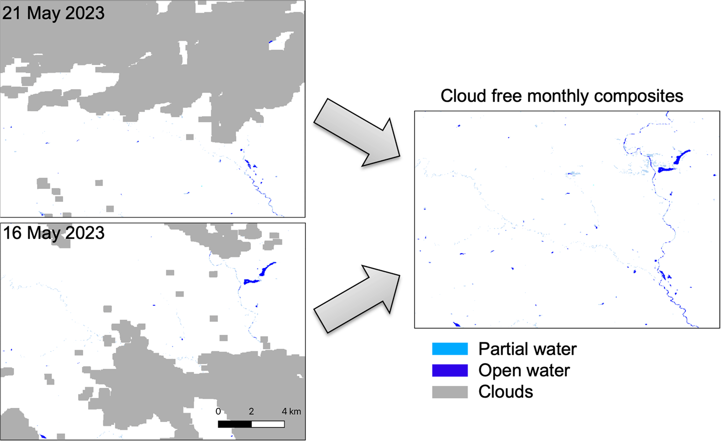


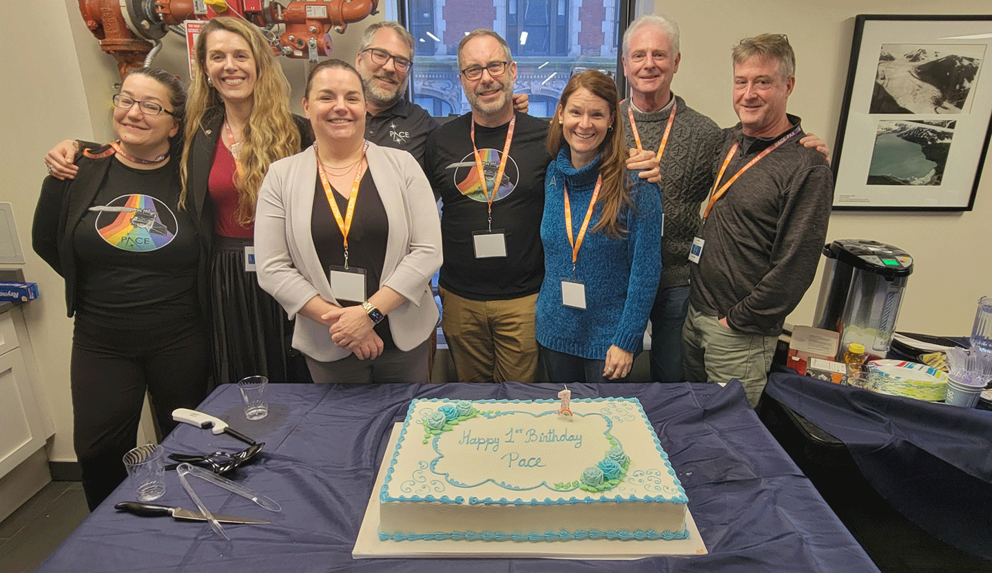

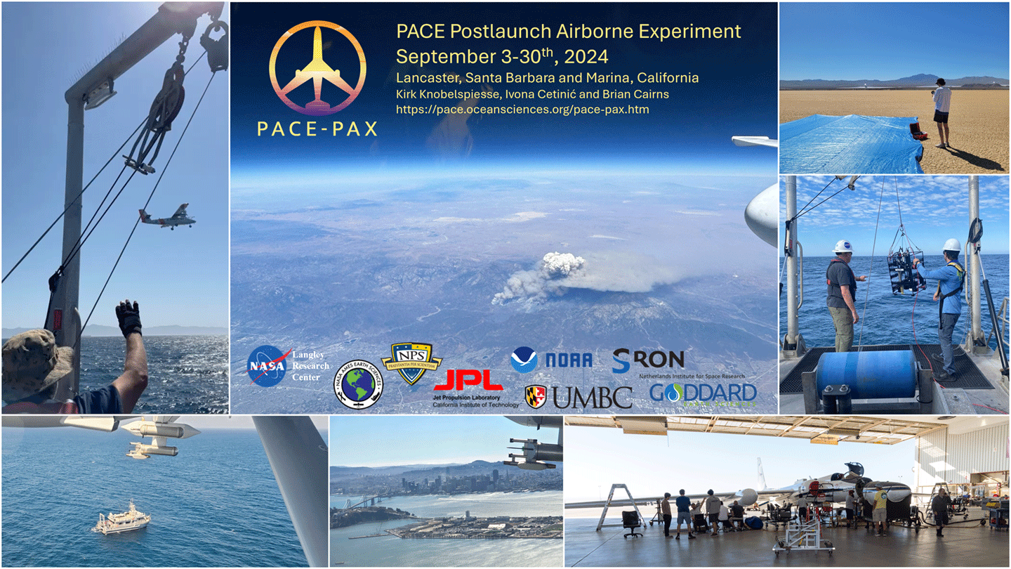
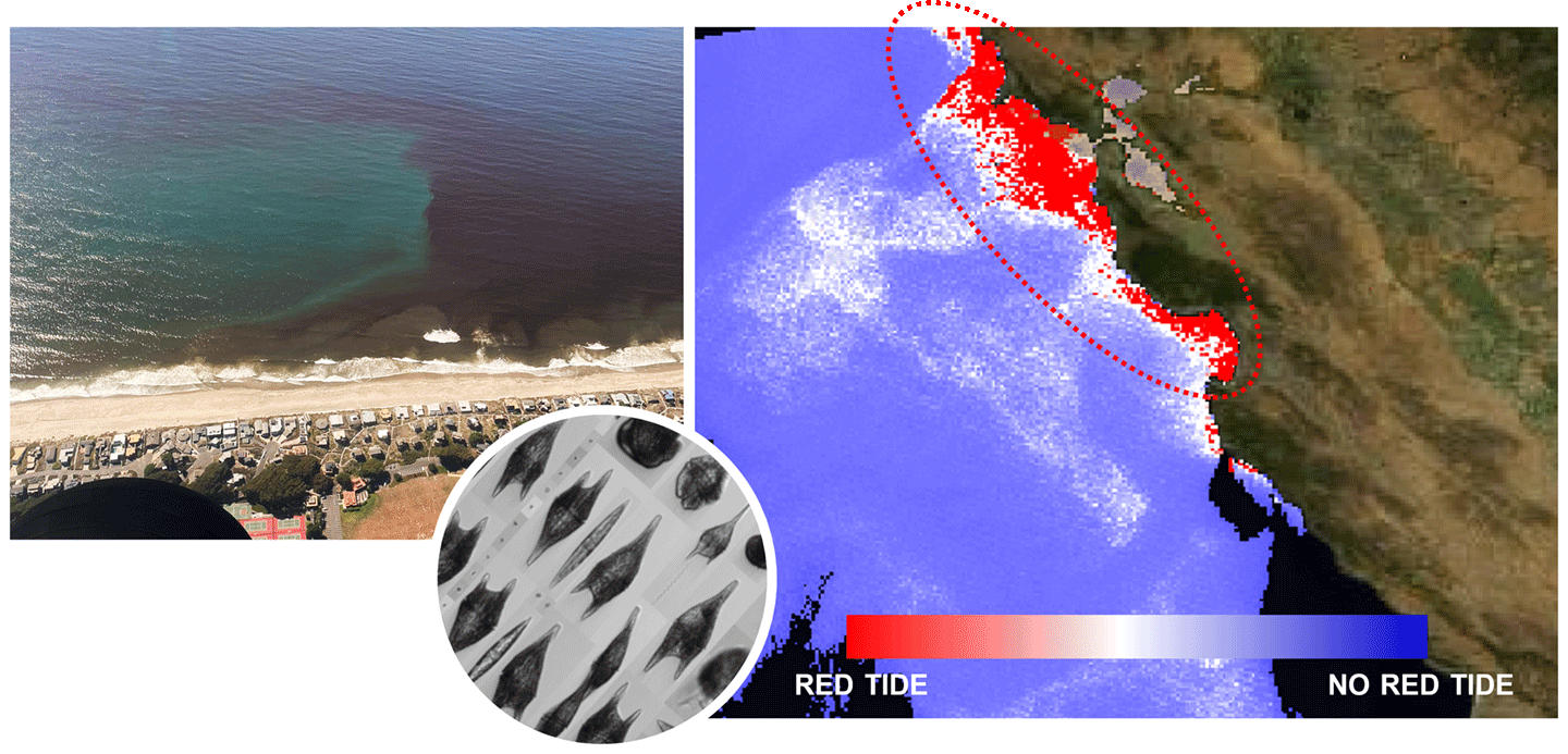
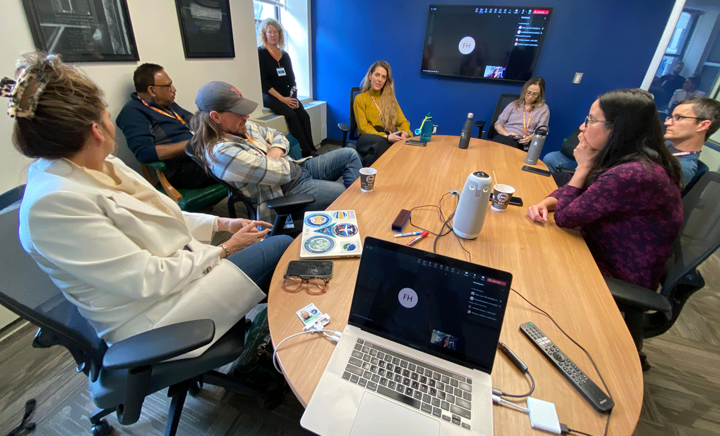


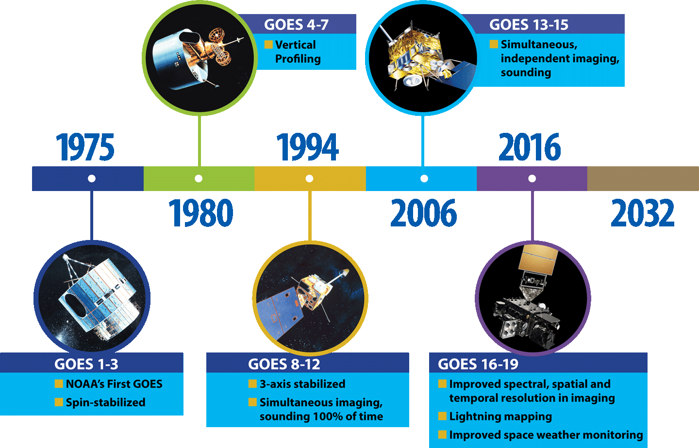
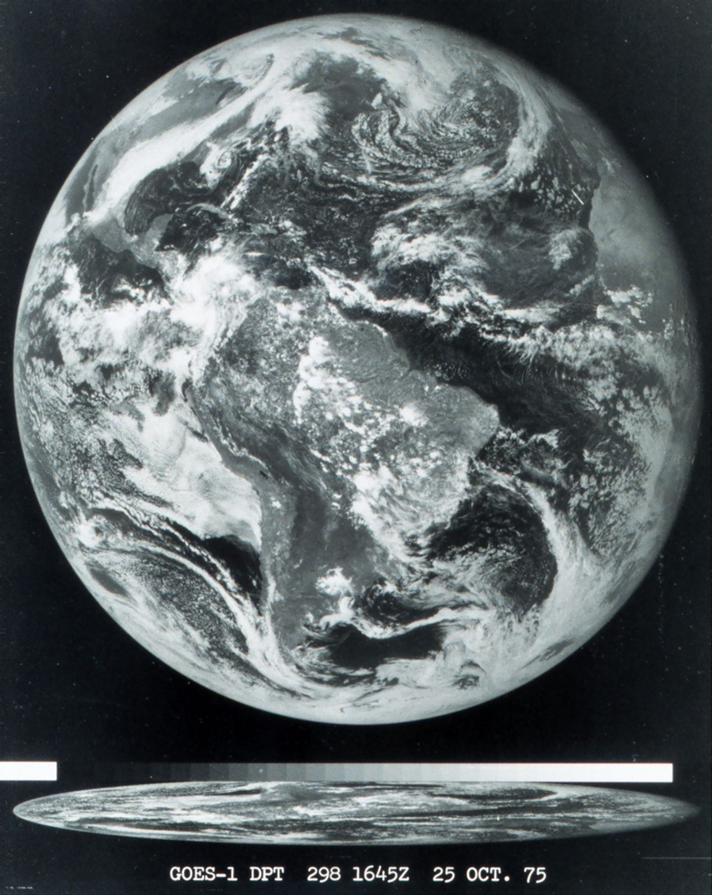
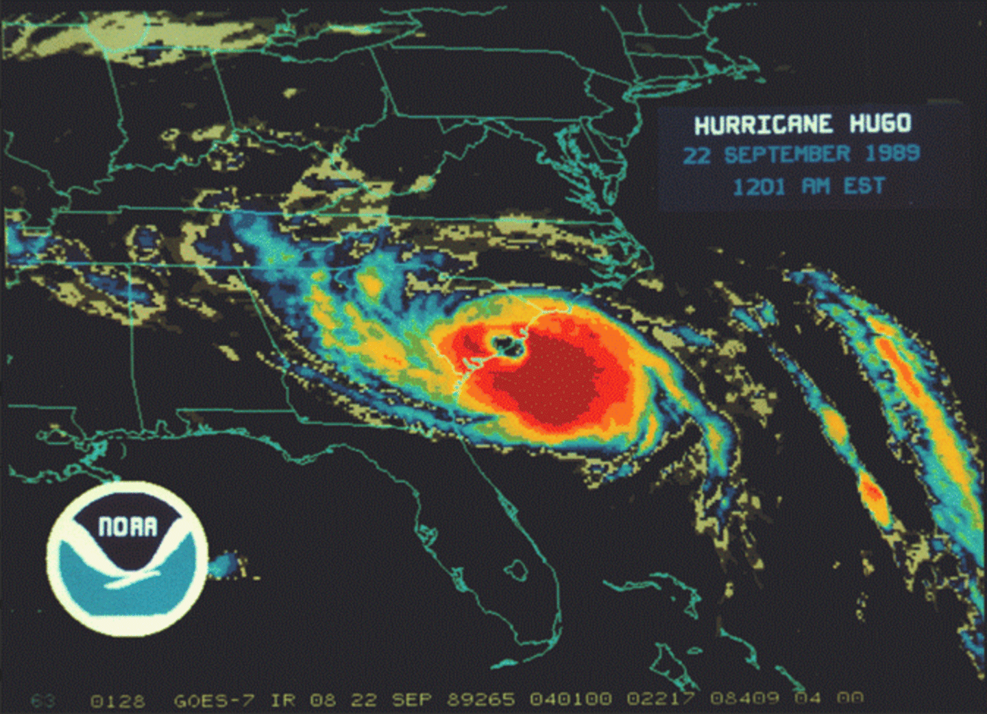
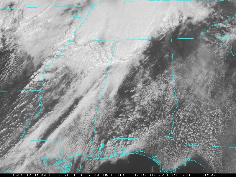


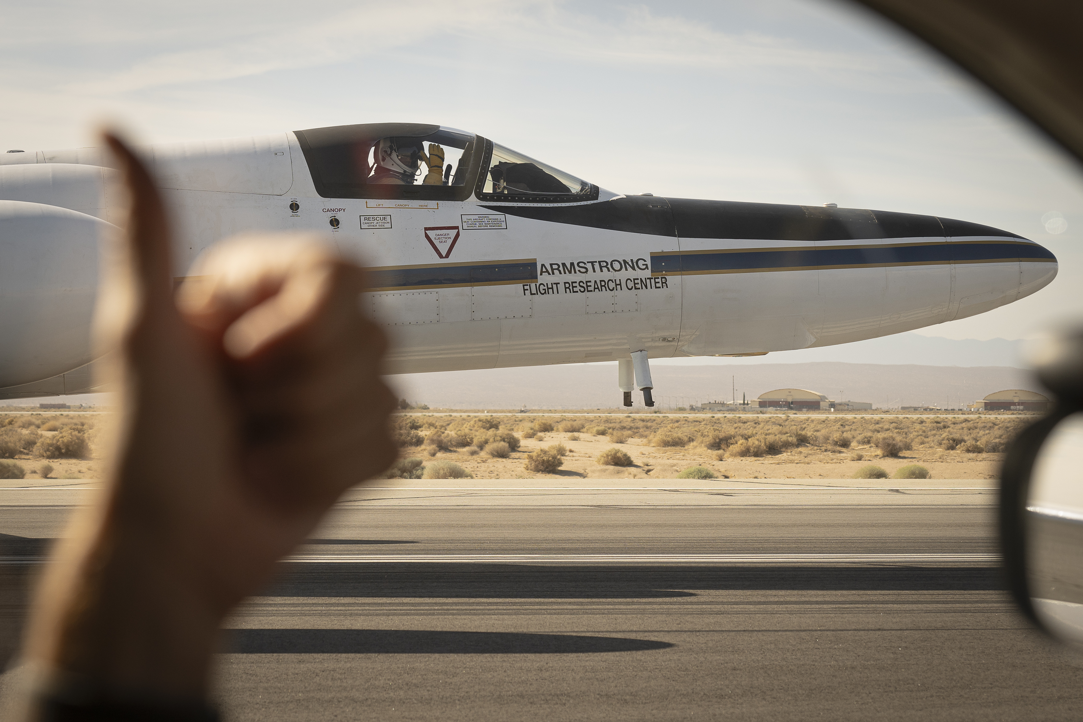

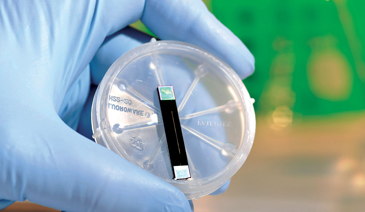


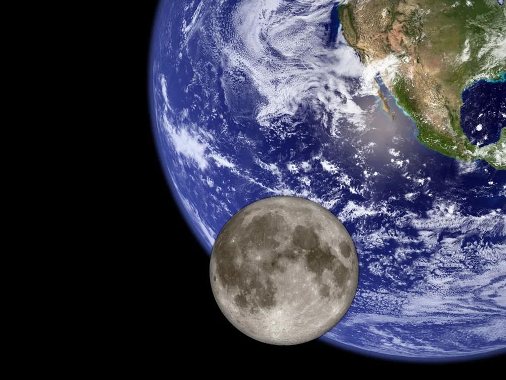


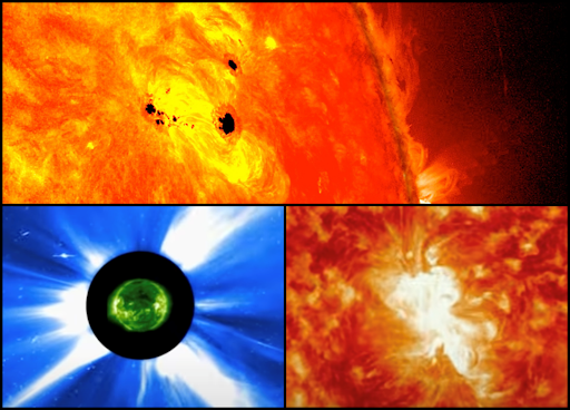


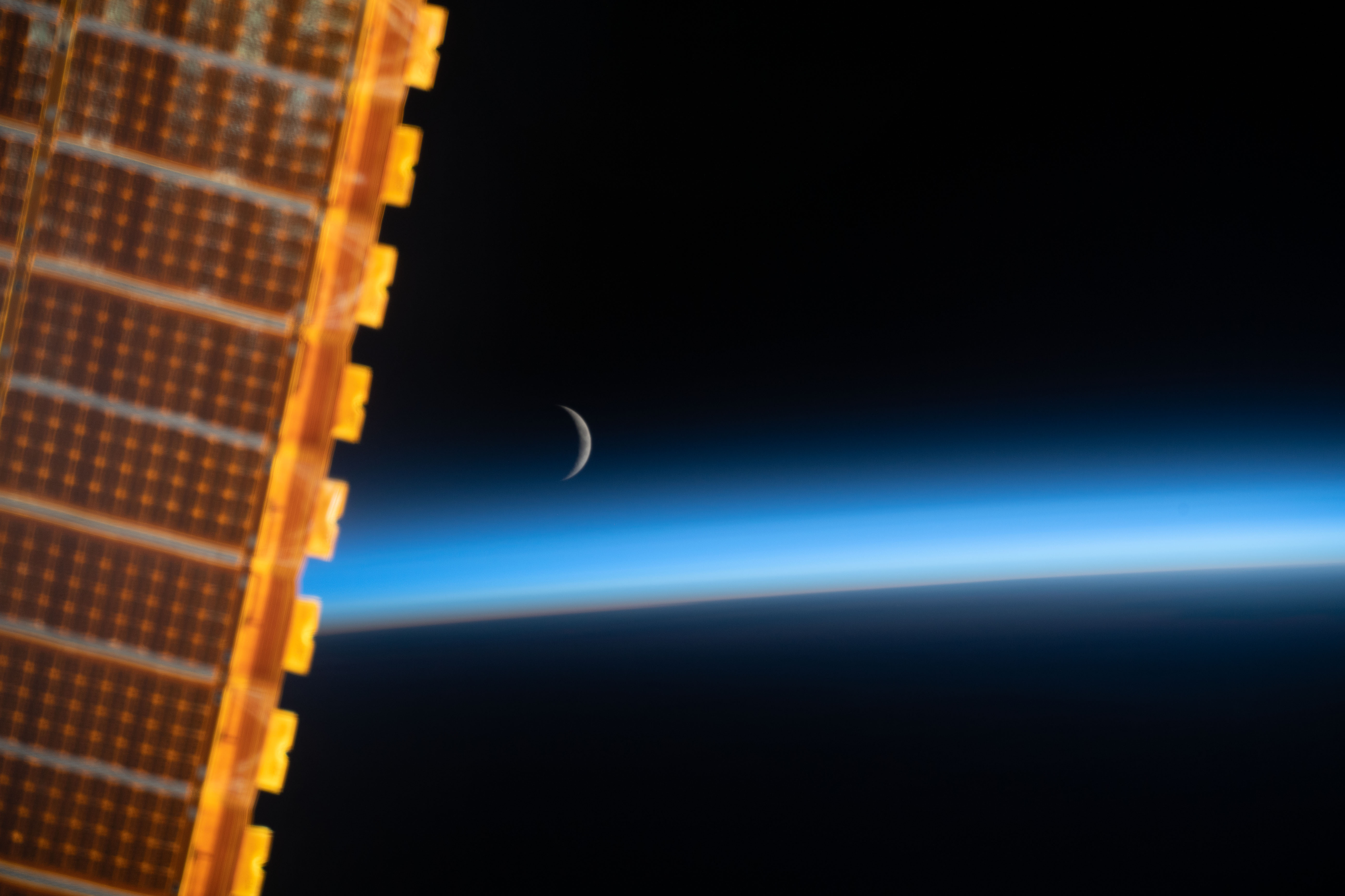
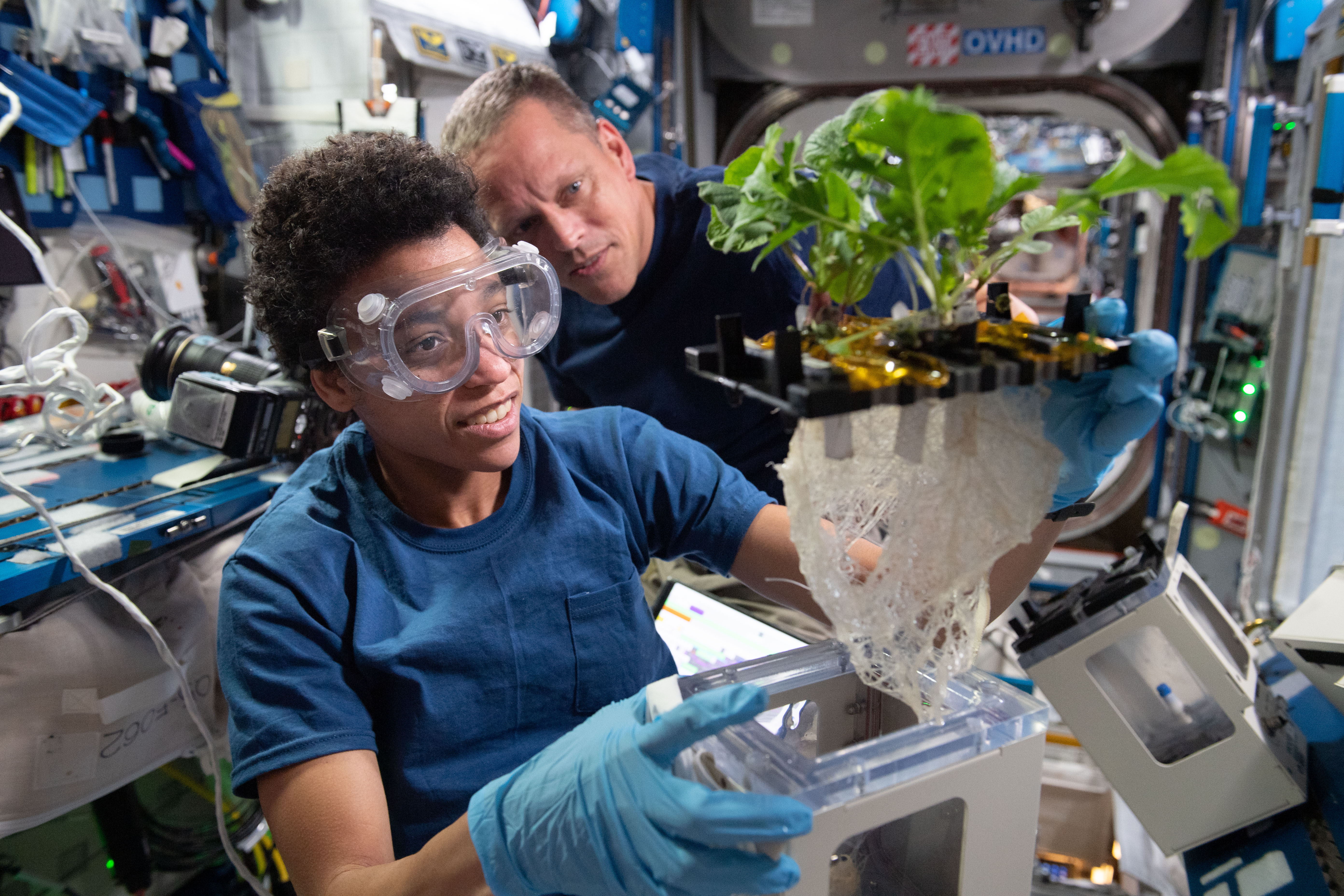
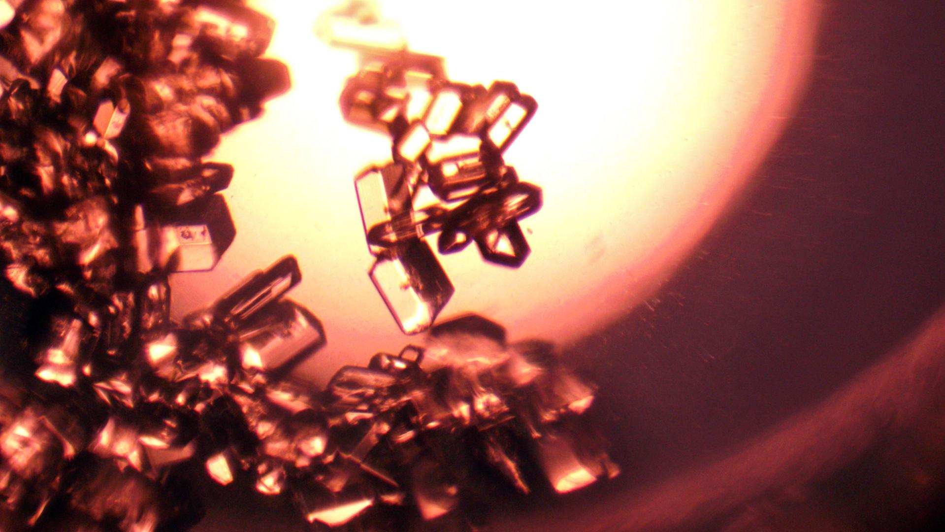
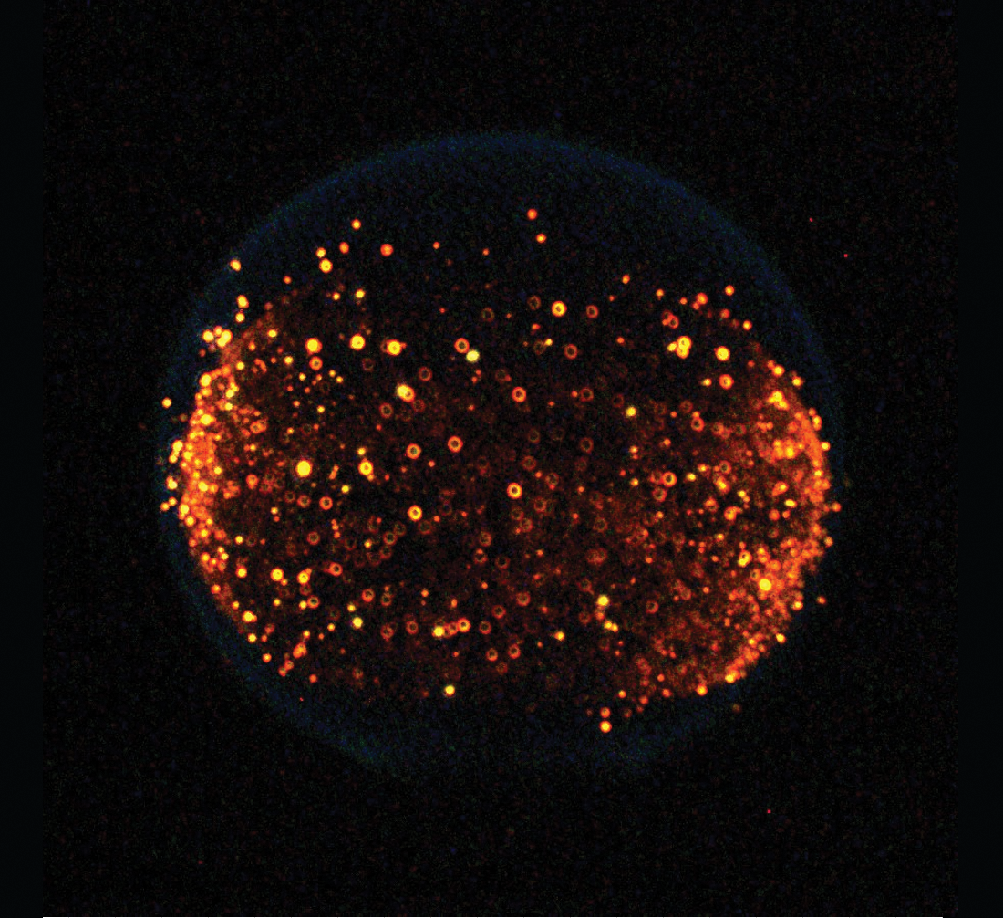


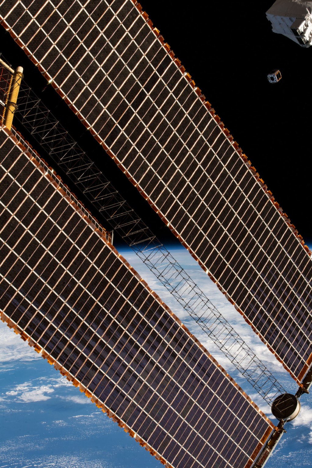
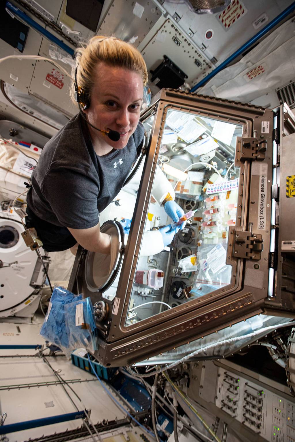
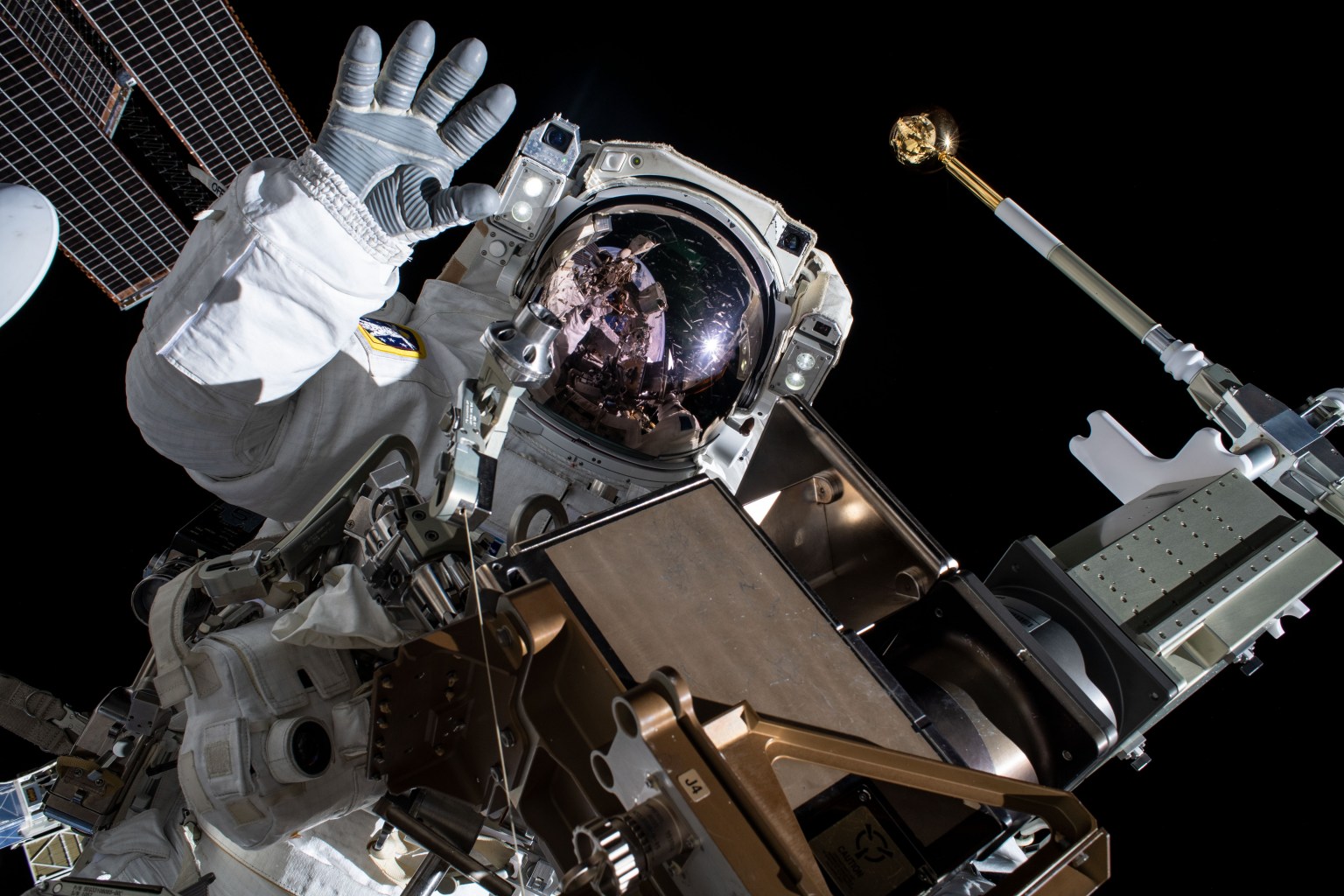
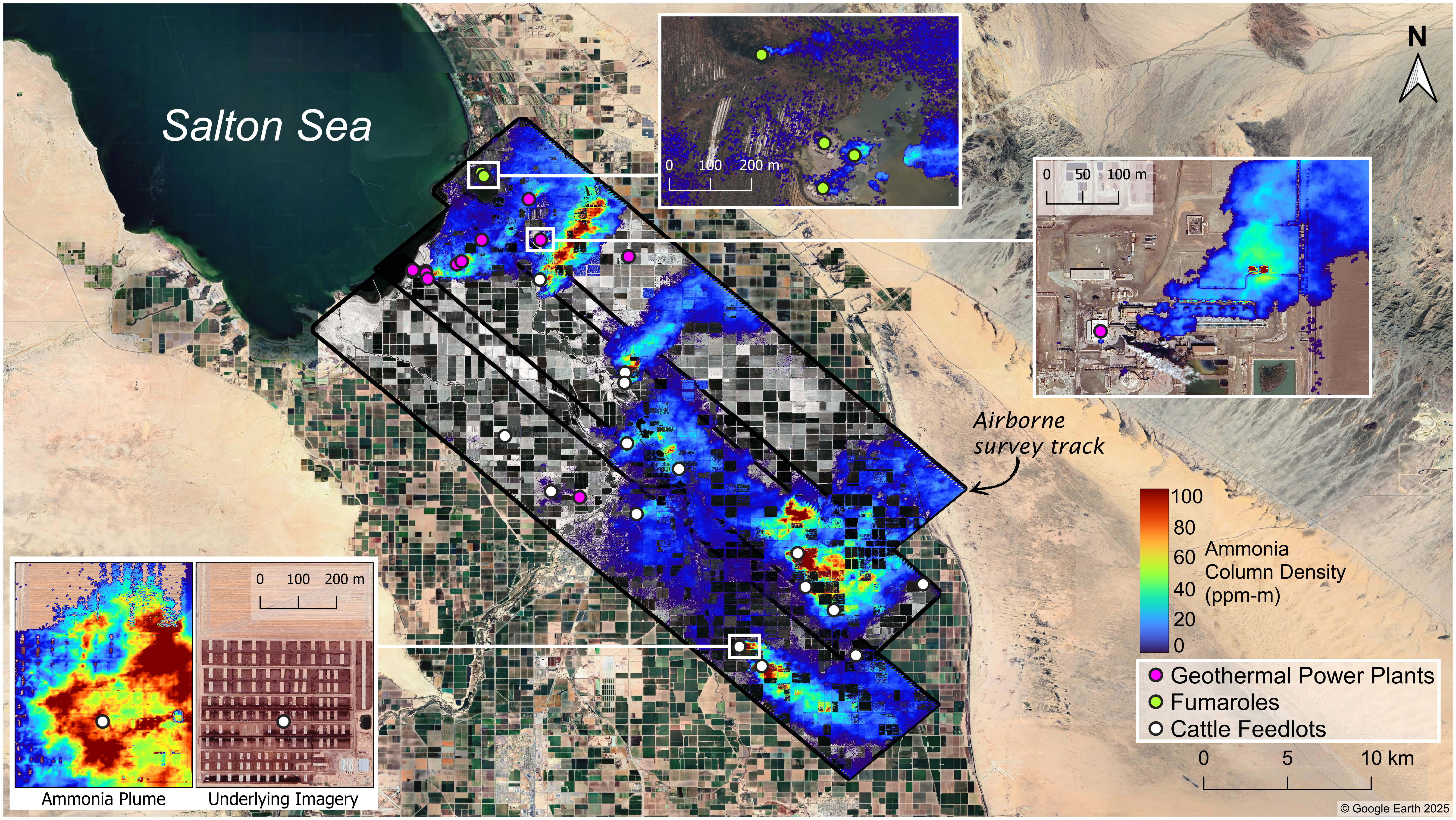


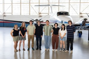

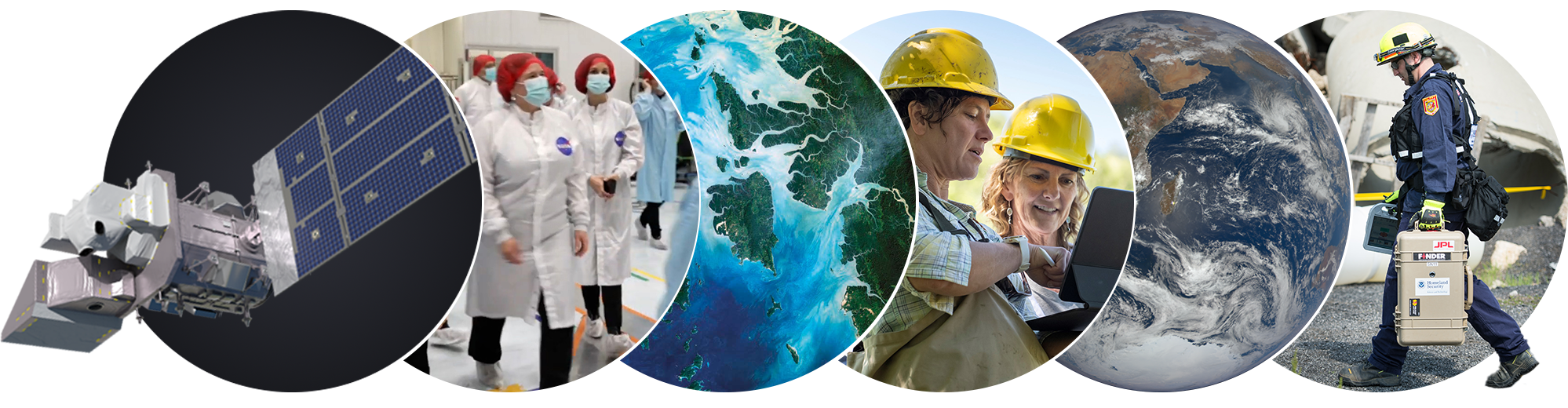
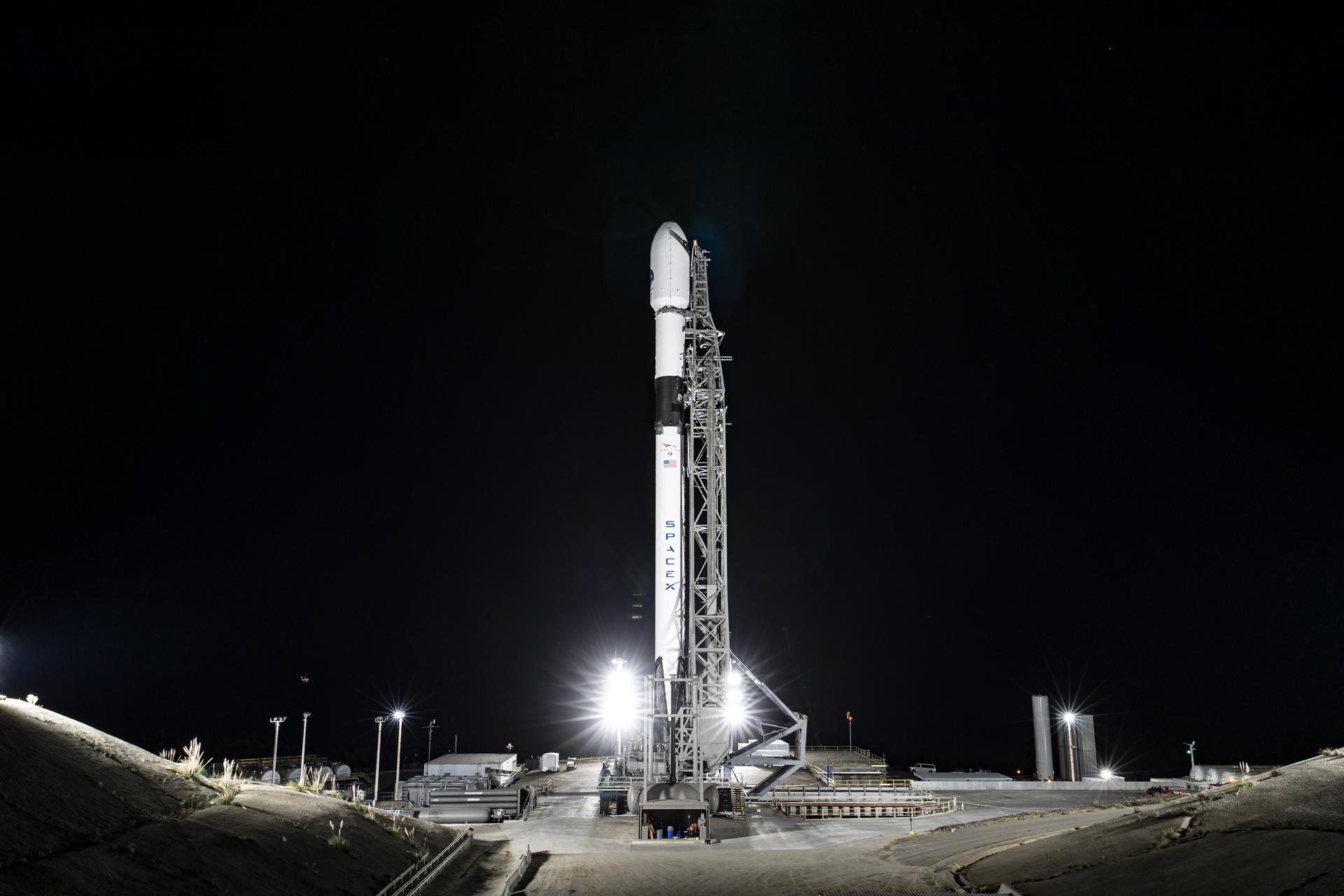


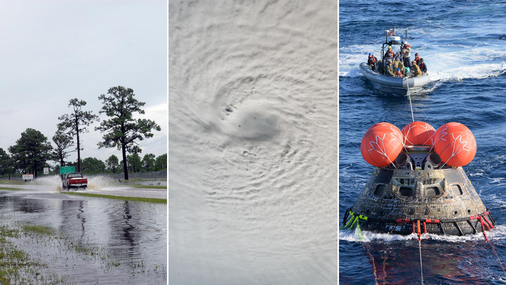
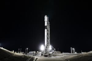
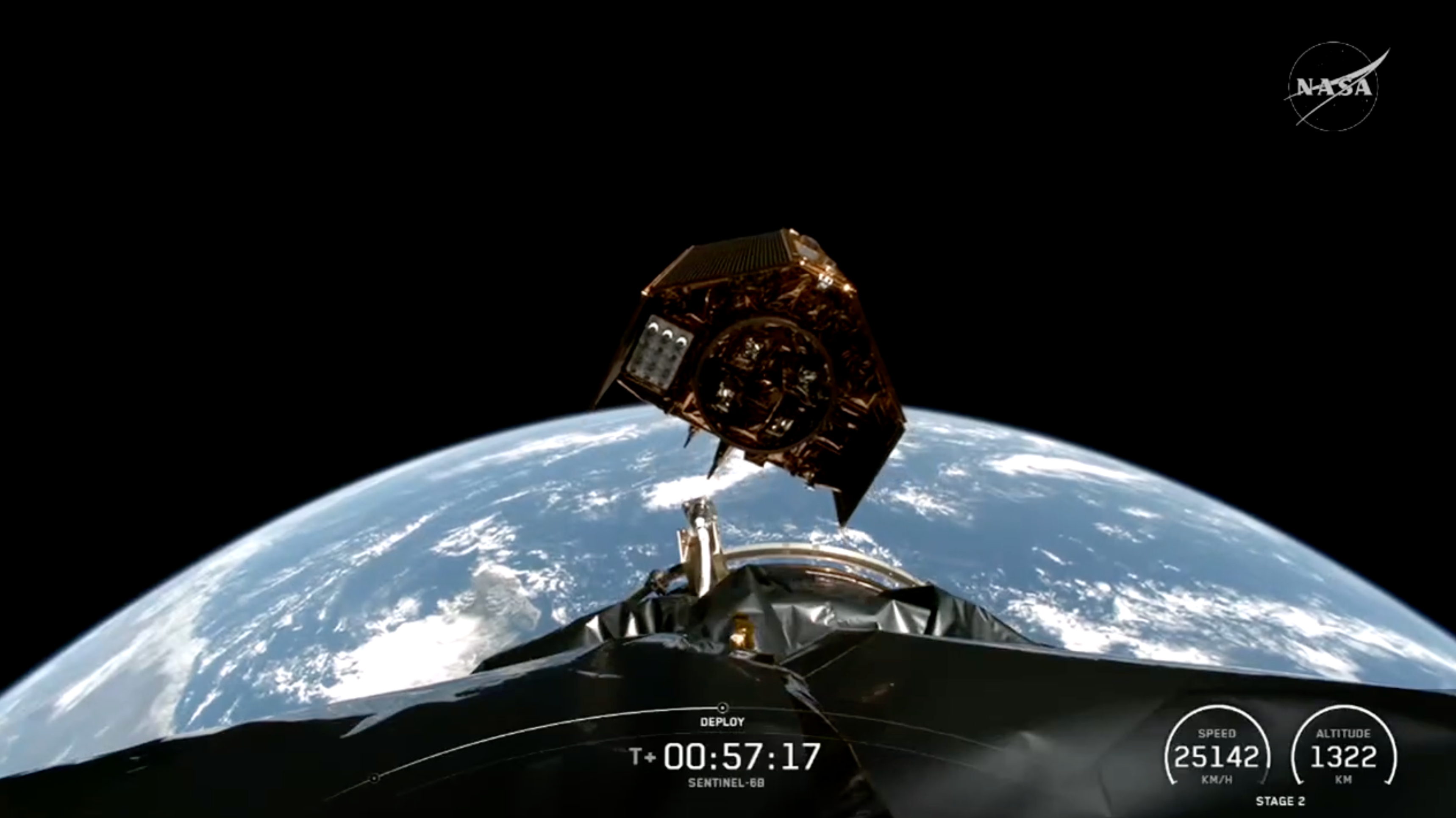
/Ocean%20Surface%20Topography%20Mission%20(OSTM%20Jason-2).png)

